Maps of Highland

Scotland 2.
1 : 760320 Letts, Son & Co.
Scotland II.
1 : 765000 Society for the Diffusion of Useful Knowledge (Great Britain)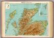
Scotland - northern section.
1 : 633600 John Bartholomew & Co.
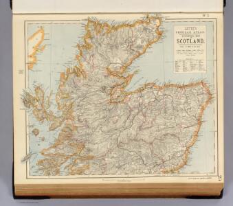
Scotland.
1 : 610000 Hughes, William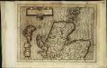
Scotiae regnvm
1 Karte : Kupferdruck ; 17 x 24 cm Mercator Cloppenburgh
Scotiae regnvm
1 Karte : Kupferdruck ; 33 x 44 cm Mercator; Hondius Henricus Hondius
Scotiæ regnvm
1 Karte : Kupferdruck ; 33 x 44 cm Mercator; Hondius Jodocus Hondius
Scotiae regnum
1 : 1100000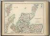
Scotland (northern sheet).
1 : 633600 Johnston, W. & A.K.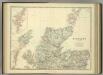
Scotland (northern sheet).
1 : 633600 Johnston, Alexander Keith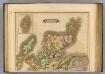
Scotland (northern)
1 : 700000 Lizars, Daniel
Extima Scotiæ septentrionalis ora
1 Karte : Kupferdruck ; 40 x 50 cm Blaeu; Gordon Joan Blaeu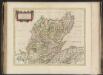
Extima Scotiae septentrionalis ora, ubi Provinciae sunt Rossia, Sutherlandia, Cathenesia, Strath-Naverniae, cum vicinis regiunculis quae eis subsunt, etiamque Moravia / R. Gordonius à Strath-loch coll
Gordon, Robert, 1580-1661 Blaeu, Joan, 1596-1673
Scotiae Provinciae intra Flumen Taum, et Murrafyrth sitae, utpote Moravia, Badenocha, Atholia, Aberdonia, Baneia et Mernis. [Karte], in: Novus atlas absolutissimus, Bd. 8, S. 163.
1 Karte aus Atlas Janssonius Offizin
Western Isles.
Thomson, John, 1777- ca. 1840 Johnson, William, fl. 1806-1840
Western Isles.
Thomson, John, 1777- ca. 1840 Johnson, William, fl. 1806-1840
Western Isles.
Thomson, John, 1777- ca. 1840 Johnson, William, fl. 1806-1840
Scotland NE.
1 : 486830 Stanford, Edward
EXTIMA SCOTIÆ | SEPTENTRIONALIS ORA, | ubi Provinciæ sunt | ROSSIA, SVTHERLANDIA, CATHENESIA, | STRATH-NAVERNIÆ, | cum vicinis regiunculis quæ eis subsunt, etiamque | MORAVIA.
R. Gordonius à Strath-loch collegit et descripsit. [Amsterdam : Joan Blaeu]
Ordnance Survey of Great Britain, Scotland
Ordnance Survey
Composite: Inverness Shire.
1 : 128000 Johnson, William, fl. 1806-1840
Extimae Scotiae pars Septentrionalis, in qua Provinciae Rossia, Sutherlandia, Cathenesia, et Strath-Naverniae. [Karte], in: Novus atlas absolutissimus, Bd. 8, S. 166.
1 Karte aus Atlas Janssonius Offizin
Scotland[Motoring Map of]
London : "Geographia
Ordnance Survey of Great Britain, Scotland
Ordnance Survey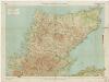
[Kaart], uit: Sutherland & Caithness
1 : 253440 titelvariant: Sutherland and Caithness; Annotatie: Titel op omslag: Sutherland and Caithness; Verso: bladoverzicht reeks Edinburgh : Bartholomew
Scotiæ provinciæ intra flumen Taum, et Murra fyrth sitæ
1 Karte : Kupferdruck ; 42 x 51 cm Valck; Schenk Gerard Valck et Pieter Schenk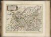
Scotiae provinciae mediterraneae inter Taum flumen et Vararis aestuarium : Sunt autem Braid-Allaban, Atholia, Marria Superior, Badenocha, Strath-Spea, Lochabria, cum Chersoneso qui ei ad occasum pra
Gordon, Robert, 1580-1661 Blaeu, Joan, 1596-1673
Scotland / J. Ainslie, 2
1 Blatt : 68 x 58 cm Ainslie, Faden
Scotiæ provinciæ mediterraneæ inter Taum flumen et vararis æstuarium: sunt autem Braid-Allaban
1 Karte : Kupferdruck ; 40 x 51 cm Blaeu; Gordon Joan Blaeu
Southern Part of Inverness Shire.
Thomson, John, 1777- ca. 1840 Johnson, William, fl. 1806-1840
Northern Part of Inverness Shire.
Thomson, John, 1777- ca. 1840 Johnson, William, fl. 1806-1840
Northern Part of Inverness Shire.
Thomson, John, 1777- ca. 1840 Johnson, William, fl. 1806-1840