Maps of Berkeley

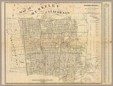
Map of Berkeley, California.
1 : 11500 Patterson, Smith & Co.
Map of Berkeley.
1 : 12000 Smith, Joseph, draftsman
3-10
Sunderland, Clyde H.
Alameda Co. 1.
1 : 31680 Thompson & West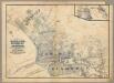
Oakland, Berkeley, Alameda.
1 : 24000 William J. Dingee
Oakland index map.
1 : 30000 Thompson & West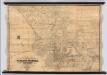
Map of Oakland, Alameda and Vicinity
1 : 10000 King, M. G. (Malcolm G.)
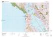
Oakland West
1 : 24000
Oakland West
1 : 24000
Oakland West
1 : 24000
Oakland West
1 : 24000
Oakland West
1 : 24000
Oakland West
1 : 24000
Oakland West
1 : 24000
Sale map no. 11. Salt marsh, tide lands, counties of Alameda & Contra Costa.
1 : 15840 Allardt, G. F.
Sale map no. 11. Salt marsh, tide lands, counties of Alameda & Contra Costa.
1 : 15840 Allardt, G. F.
2-26
Sunderland, Clyde H.
Shell Street Map of East Bay Cities.
1 : 38016 Shell Oil Company
United States--West coast, san Francisco Entrance, California
1 : 50000 U.S. Coast and Geodetic Survey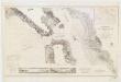
Entrance to San Francisco Bay, California
1 : 50000 United States Coast Survey The Survey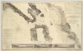
Entrance to San Francisco Bay California.
1 : 50000 United States Coast Survey
Mare Island Straits, California from a trigonometrical survey under the direction of A.D. Bache, Superintendent of the Survey of the Coast of the United States.
1 : 130000 Relief shown by hachures. Depths shown by soundings. Shows drainage, buildings, wharves, etc. Facsimile. "Reproduced from the annual reports by permission of United States Coast & Geodetic Survey." Oriented with north toward upper left. Includes text and table of abbreviations. "No. 61." United States Coast Survey., P. Witzel (Peter), Rose Research Austin, Tex. : Rose Research
San Pablo Bay, Carquines Straits.
1 : 455000 Stuart, F. D. (Fred. D.)
San Francisco and vicinity, California
1 : 62500 U.S. Geological Survey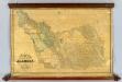
The County Of Alameda California.
1 : 95040 Higley, Horace A.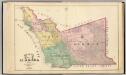
Alameda County map.
1 : 126720 Thompson & West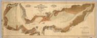
Map exhibiting the salt marsh ... lands adjacent to the bays of San Francisco and San Pablo.
1 : 50000 California. Board of State Harbor Commissioners for San Francisco Harbor
Composite: San Francisco Bay Area Structure Sections. 1914.
1 : 62500 Merriam, John C.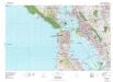
San Francisco
1 : 100000