Maps of United States
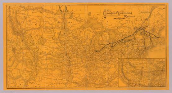
Central Vermont Railroad, connections.
1 : 4822200 Central Vermont Railroad Company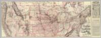
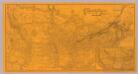
Chicago-Milwaukee & St. Paul Railway and connections.
1 : 4700000 Chicago, Milwaukee, and St. Paul Railway Company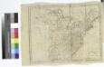
The United States of America / W. Barker sculp., Philadelphia.
from Carey's American pocket atlas; containing nineteen maps... with a brief description of each state.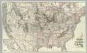
Chicago Milwaukee and St. Paul Ry. and connections.
1 : 4840000 Chicago, Milwaukee, and St. Paul Railway Company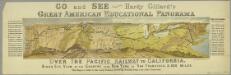
Go and see Hardy Gillard's great American educational panorama, Over the Pacific Railway to California : bird's eye view of the country from New York to San Francisco, 3,500 miles.
from Parts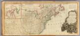
North America (north)
1 : 5400000 Robert Laurie & James Whittle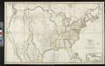
Map of the United States: with the contiguous British & Spanish possessions / compiled from the latest & best authorities by John Melish; engraved by J. Vallance & H.S. Tanner.
from Whole John Melish; J. Vallance; Henry S. Tanner,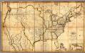
Map of the United States with the contiguous British & Spanish Possessions.
1 : 3900000 Melish, John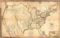
Composite: Map of the United States with the contiguous British & Spanish Possessions.
1 : 3900000 Melish, John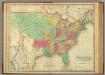
United States Of America.
1 : 7603200 Lea, I.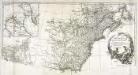
Amérique septentrionale, 2
2 Blätter : mehrfarbig ; 52 x 113 cm chez l'auteur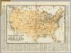
Radio Broadcasting Stations Of The United States.
1 : 8236800 Clason Map Company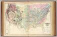
U.S. geological map.
1 : 6696600 Asher & Adams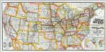
Great Rock Island Route.
1 : 4167680 Chicago, Rock Island and Pacific Railway Company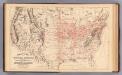
Railroad map U.S.
1 : 7850000 Mitchell, Samuel Augustus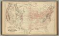
Railroad map U.S.
1 : 7850000 Mitchell, Samuel Augustus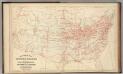
Railroad map U.S.
1 : 7850000 Mitchell, Samuel Augustus Jr.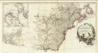
Amerique Septentrionale. (Northern section).
1 : 6300000 Anville, Jean Baptiste Bourguignon d, 1697-1782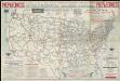
National highways map of the United States showing principal transcontinental highways and connecting system of one hundred thousand miles of national highways proposed by the National Highways Association
1 : 3800000 Mulford, John C. National Highways Association
Gray's Botanical and Zoological Maps of the United States.
1 : 18000000 Gray, Ormando Willis
Acquisition of territory US.
1 : 10300000 United States. Census Office
United States.
from Whole D.F. Robinson & Co.: [Hartford, Conn.];,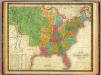
Map of the United States.
1 : 7000000 Mitchell, Samuel Augustus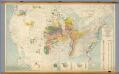
United States -- Pleistocene Eolian Deposits
1 : 2500000 The Geological Society of America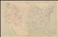
United States contour map
1 : 7000000 Geological Survey (U.S.) Geological Survey (U.S.)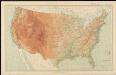
United States relief map
1 : 7000000 Geological Survey (U.S.) Geological Survey (U.S.)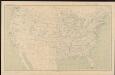
United States base map
1 : 7000000 Geological Survey (U.S.) Geological Survey (U.S.)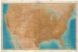
Relief map of the United States
1 : 3168000 Spojené státy americké Renshawe, John H. U. S. Geological Survey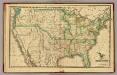
United States.
1 : 11300000 Morse, Sidney E. (Sidney Edwards), 1794-1871