Maps of Oklahoma

Nebraska and Kansas.
1 : 3850000 Colton, J. H.
Country drained by the Mississippi Western Section.
1 : 4752000 Long, Stephen H.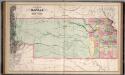
A New Map of Kansas.
1 : 1457280 Mitchell, Samuel Augustus
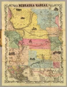
Nebraska, Kansas, New Mexico, and Indian Territories
1 : 6600000 Mitchell, Samuel Augustus
Nebraska, Kansas, New Mexico, and Indian Territories
1 : 6600000 Mitchell, Samuel Augustus
Map showing the lands assigned to emigrant Indians west of Arkansas & Missouri / prepared at the Topographical Bureau Feby. 23d, 1836, [by] R. Jones, Adj. Gene.
from Parts
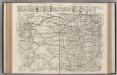
Nebraska and Kansas.
1 : 3850000 Colton, J. H.
Map of Kansas, Nebraska, and Colorado. Showing also the eastern portion of Idaho.
from New general atlas.
State of Kansas, and Nebraska and Indian Territories.
1 : 3000000 Colton, G.W.
Map of an exploring expedition to the Rocky Mountains in the year 1842 and to Oregon & north California in the years 1843-44 / by Brevet Capt. J.C. Frémont of the Corps of Topographical Engineers under the orders of Col. J.J. Abert, Chief of the Topog...
From Parts
Indian Territory, Northern Texas and New Mexico.
1 : 3600000 Gregg, Josiah, 1806-1850
Indian Terr., N. Texas, N.M.
1 : 3500000 Morse, Sidney E. (Sidney Edwards), 1794-1871
Kansas, and Nebraska and Indian Territories.
1 : 3000000 Colton, G.W.
U.S.A. Great Plains South, Plate 109, Vol. V
1 : 2500000 Bartholomew, John
Map Of The States Of Kansas And Texas And Indian Territory.
1 : 1500000 U.S. War Department
Nebraska and Kansas.
1 : 3850000 Colton, J. H.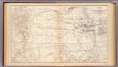
Kansas, Texas, Indian Territory.
1 : 1900000 United States. War Department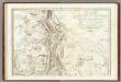
Carte Generale Du Royaume De La Nouvelle Espagne.
1 : 3000000 Humboldt, Alexander von, 1769-1859
Kan., Neb., Colo.
1 : 4000000 Mitchell, Samuel Augustus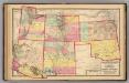
Kansas, and Arizona, Colorado, New Mexico, Utah, and Indian Territory.
1 : 3000000 Lloyd, H.H.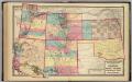
Kansas, and Arizona, Colorado, New Mexico, Utah, and Indian Territory.
1 : 3000000 Walling, H. F.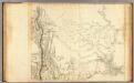
Mexico 4.
1 : 2500000 Humboldt, Alexander von, 1769-1859
Texas.
1 : 6800000 Mitchell, Samuel Augustus
Post route map of the states of Kansas and Nebraska : showing post offices with the intermediate distances and mail routes in operation on the 1st of December, 1900 / published by order of Postmaster General Charles Emory Smith under the direction of A.
from Parts
Nebraska. Oklahoma.
1 : 1665000 Hammond, C.S.
Indian Territory (Oklahoma). Nebraska.
1 : 1497000 Gray, Ormando Willis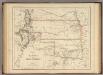
Territory of Kansas And Indian Territory.
1 : 3453120 Rogers, Henry Darwin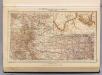
142. Colo., Kans.
1 : 3000000 Touring club italiano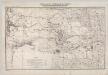
Indian Territory With Parts Of Neighboring States And Territories.
1 : 1200000 Jackson, Henry