Maps of Manitoba

Manitoba.
Rand McNally and Company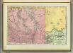
Manitoba.
1 : 1500000 Rand McNally and Company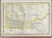
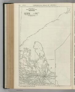
Manitoba.
1 : 1680000 Rand McNally and Company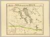
Partie, Nouvelle Bretagne. Amer. Sep. 33.
1 : 1641836 Vandermaelen, Philippe, 1795-1869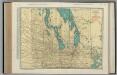
Manitoba.
1 : 1014000 Rand McNally and Company
Ontario. Manitoba.
1 : 1829000 Hammond, C.S.
Manitoba.
1 : 1521000 Rand McNally and Company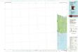
Angle Inlet
1 : 100000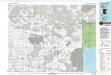
Angle Inlet
1 : 100000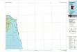
Oak Island
1 : 100000
Oak Island
1 : 100000
Buffalo Bay
1 : 62500
Oak Island
1 : 62500
Buffalo Bay NW
1 : 24000
Garden Island West
1 : 24000
Garden Island East
1 : 24000
Angle Inlet
1 : 24000
Angle Inlet SW
1 : 24000
Flag Island
1 : 24000
Oak Island
1 : 24000
Winnipeg
1 : 31500 Chalifour, J.E.
Map of the Vicinity of the North West Point of the Lake of the Woods.
1 : 10560 Twining, W.J.
Humboldt
1 : 24000
Orleans
1 : 24000
Hallock NE
1 : 24000
Bathgate
1 : 24000
Sarles
1 : 24000
Sarles NE
1 : 24000
Wales
1 : 24000
Hannah
1 : 24000
Mount Carmel
1 : 24000
Bathgate NE
1 : 24000
Rolla NE
1 : 24000
Saint John
1 : 24000
Hansboro
1 : 24000
Hansboro NE
1 : 24000
Rock Lake NW
1 : 24000
Olga NW
1 : 24000
Boundary Lake
1 : 24000
Carpenter Lake
1 : 24000
International Peace Garden
1 : 24000
Lake Upsilon
1 : 24000
Warroad NW
1 : 24000
Warroad
1 : 24000
Warroad
1 : 24000
Roosevelt NW
1 : 24000
Roosevelt NE
1 : 24000
Williams NW
1 : 24000
Skull Lake
1 : 24000
Skull Lake NE
1 : 24000
Caribou NE
1 : 24000
Badger NW
1 : 24000
Pinecreek
1 : 24000
Salol NW
1 : 24000
Roseau NE
1 : 24000
Salol NW
1 : 24000
Roseau NE
1 : 24000
Salol NE
1 : 24000
Salol NE
1 : 24000
Leroy
1 : 24000
Walhalla
1 : 24000
Leroy
1 : 24000
Walhalla
1 : 24000
Cavalier NW
1 : 24000
Neche
1 : 24000
Carbury
1 : 24000
Lake McArthur
1 : 24000
Metigoshe Lake
1 : 24000
Metigoshe Lake
1 : 24000
Souris
1 : 24000
Roth
1 : 24000
Roth
1 : 24000
Kuroki
1 : 24000
Westhope
1 : 24000
Westhope
1 : 24000
Antler NW
1 : 24000
Landa
1 : 24000
Northgate
1 : 24000
Bowbells NW
1 : 24000
Bowbells NE
1 : 24000
Mouse River Park NW
1 : 24000
Mouse River Park NE
1 : 24000
Mouse River Park NE
1 : 24000
Mohall NE
1 : 24000
Landa
1 : 24000