Maps of Central Valley
California (Northern Section).
1 : 1140000 Rand McNally and Company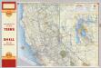
Shell Highway Map of California (northern portion).
1 : 1330560 Shell Oil Company
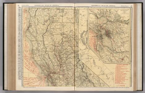
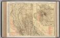
California and Nevada. North Portion.
1 : 1290000 Asher & Adams
California, Nevada (upper)
1 : 696960 Von Haake, A.
Calif., Nev. north.
1 : 1267200 Asher & Adams
Map of northern California showing general plan for the reclamation of the entire Sacramento and San Joaquin Valleys
1 : 11450000 Brown line print. Shows which areas are to be irrigated by which specific rivers. "Map A" Marshall, R. B. (Robert Bradford). 1867-1949. [S.N.
Irrigation map of southern California.
1 : 506880 U.S. Dept. of Agriculture, Bureau of Public Roads, Irrigation Investigations.|~|"Revised and redrawn 1920 in cooperation with California State Dept. of Engineering; College of Agriculture, University of California; California State Water Commission."|~|Covers the area from Owens Lake over to Santa Barbara County, south to the Mexican border.|~|Includes location map and inset of Owens Valley.|~|Relief represented by shading.|~|Shows agricultural areas, irrigated areas, irrigation canals, boundaries of irrigation districts, principal hydroelectric plants, U.S. Geological Survey and private stream gauging stations, and rainfall stations.|~|UCLA Catalog Record United States. Bureau of Public Roads. The Bureau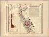
Nouvelle Californie. Amer. Sep. 46.
1 : 1641836 Vandermaelen, Philippe, 1795-1869
California, Nevada (NW)
1 : 633600 United States. Post Office Dept.
California, Nevada (NW)
1 : 633600 United States. Post Office Dept.
DeGroot's Map Of Nevada Territory.
1 : 776160 Holt, Warren
San Francisco Bay to N. boundary of California.
1 : 760320 Williamson, R.S.
Northern California.
1 : 2150000 Holdredge, Sterling M.
Topographical Map of Central California Together With a Part of Nevada, Sheet IV.
1 : 380160 Whitney, J.D.
Topographical Map of Central California Together With a Part of Nevada, Sheet I.
1 : 380160 Whitney, J.D.
Topographical Map of Central California Together With a Part of Nevada, Sheet II.
1 : 380160 Whitney, J.D.
Composite: Topographical Map of Central California Together With a Part of Nevada, Sheets III-IV.
1 : 380160 Whitney, J.D.
Composite: Topographical Map of Central California Together With a Part of Nevada, Sheets I-IV.
1 : 380160 Whitney, J.D.
Topographical Map of Central California Together With a Part of Nevada, Sheet III.
1 : 380160 Whitney, J.D.
From the Mud Lakes to Pacific Ocean.
1 : 760320 Beckwith, E.G.
Pageant of history in Northern California
"Published on its 100th anniversary by American Trust Company, San Francisco." "Lithogravure in U.S.A." Sheets, Millard San Francisco : American Trust Co
Map Of The San Joaquin, Sacramento And Tulare Valleys.
1 : 760320 United States. Congress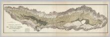
Topographical and Irrigation Map of the Great Central Valley of California.
1 : 380000 California State Engineering Department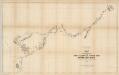
Map of the Western Division of the Fort Kearney South Pass and Honey Lake Road.
1 : 760320 Campbell, Albert
From the Humboldt Mountains to the Mud Lakes.
1 : 760320 Beckwith, E.G.
Bancroft's New Map Of Central California.
1 : 760320 Knight, W.H.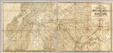
The Central Part of the State of California.
1 : 253440 Poett, A.
A complete map of the Feather & Yuba Rivers
1 : 1700000 Relief shown by hachures.Facsimile. Includes view of Marysville. A complete map of the Feather & Yuba Rivers: with towns, ranches, diggings, roads, distances / compiled from the recent surveys of M. Milleson & R. Adams ; drawn by M. Milleson. Milleson, M., Adams, R., Eddy, RA Marysville, Calia : R.A. Eddy.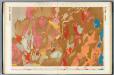
Nevada Basin. (Geological)
1 : 253440 King, Clarence