Maps of Piedmont
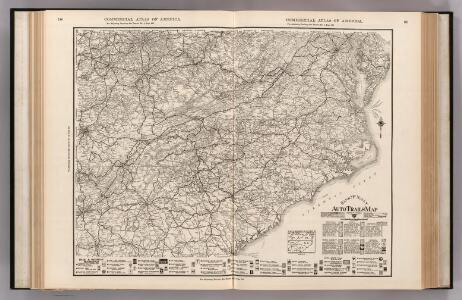
Auto Trail Map. Indiana, Ohio, Virginia, North Carolina, South Carolina, Georgia.
1 : 1893000 Rand McNally and Company
Army of the Cumberland.
1 : 7800000 National Tribune Co.
Carte des Provines Meridionales des Etats-Unis.
1 : 2400000 Marshall, John
A map of Virginia, North and South Carolina, Georgia, Maryland with part of New Jersey &c.
from Parts Printed for R. (Richard) Baldwin in Pater Noster Row: [London] -- Bookseller,
Carte des Etats-unis : provinces méridionales.
from Parts
Army of the Cumberland campaigns.
1 : 2200000 United States. War Department

Maryland, Virginia, North Carolina, and South Carolina.
1 : 3651000 Fisher, Richard Swainson
Nouvelle carte de la Caroline / par R. Morden.; L'Amerique angloise, ou Description des isles et terres du roi d'Angleterre, dans l'Amérique. Avec de nouvelles cartes de chaque isle & terres. Traduit de l'anglois.
from L'Amerique angloise, ou Description des isles et terres du roi d'Angleterre, dans l'Amérique. Avec de nouvelles cartes de chaque isle & terres. Traduit de l'anglois. Blome, Richard,
States Of Delaware, Maryland, Virginia (with the District of Columbia) North Carolina, Ohio, Kentucky, Tennessee, And Indiana.
1 : 3453120 Rogers, Henry Darwin
Campaigns in which the Army Of The Cumberland Took part during the War of the Rebellion.
1 : 1267200 Ruger, Edward
Neueste Karte von Nord Carolina mit seinen Canaelen, Strassen, Eisenbahnen, Entfernungen der Hauptpunkte und Routen für Dampfschiffe
Grosser Hand-Atlas über alle Theile der Erde in 170 Karten Meyer, J. Verlag des Bibliographischen Instituts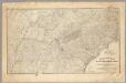
Military map showing the marches of the United States Forces 1863-1865.
1 : 1267200 United States. Army. Military Division of the Mississippi
North Carolina.
1 : 2050000 Colton, G.W.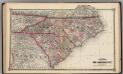
Schonberg's Map of North Carolina and South Carolina.
1 : 1900000 Schonberg & Co.
Virginia, North Carolina, South Carolina.
1 : 1584000 Smith, J. Calvin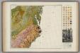
Soil Map of the United States, Section 8. Atlas of American Agriculture.
1 : 2500000 Marbut, Curtis F.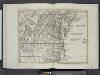
Il Maryland, il Jersey Meridionale, la Delaware e la parte orientale della Virginia, e Carolina Settentrionale.
from Le colonie unite dell' America settentrle : di nuova projezione a s.s.e.e. li Signori Riformatori dello Studio di Padova.
North Carolina. South Carolina.
1 : 2012000 Gray, Ormando Willis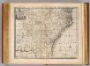
N. & S. Carolina, Georgia &c.
1 : 2900000 Bowen, Emanuel
North Carolina.
1 : 1960000 Mitchell, Samuel Augustus
North Carolina.
1 : 1960000 Mitchell, Samuel Augustus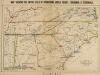
Map, shewing the Entire Field of Operations under Grant, Sherman & Thomas
Map, shewing the Entire Field of Operations under Grant, Sherman & Thomas. Published in London by Bacon & Co., this image of a Map Shewing the Entire Field of Operations, Under Grant, Sherman & Thomas details the Deep South Confederate States, principally of Tennessee, North Carolina, South Carolina, Georgia and Alabama, as well Virginia and the Union state of Kentucky. These areas witnessed the Union Army push in the last year and a half of the war, under the leadership of General Ulysses S. Grant. General George H. Thomas predominately fought in the western theatre of the conflict, while General William T. Sherman was responsible for the Army’s ultimately devastating march through the Southern states in 1864 and 1865. His marches through Georgia and the Carolinas, which crippled the home–front, remain a vital part of Civil War military history and Southern memory of the conflict. Bacon & Co.
Virginiae partis australis, et Floridae partis orientalis, interjacentiumq[ue] regionum, nova descriptio.
from John H. Levine Collection Meurs, Jacob van; Montanus, Arnoldus,
Virginiae partis australis, et Floridae partis orientalis, interjacentiumq[ue] regionum nova descriptio.
from Parts J. and C. Blaeu: [Amsterdam]; Blaeu, Joan; Blaeu, Willem Janszoon,
Virginiae partis australis et Floridae partis orientalis interjacentimq[ue] regionum, nova descriptio.
from Charts and maps Ioannem Ianssonium?: [Amstelodami?]; Jansson, Jan,
Virginiae partis australis, et Floridae partis orientalis, interjacentiumq[ue] regionum nova descriptio.
from Parts J. and C. Blaeu: [Amsterdam]; Blaeu, Joan; Blaeu, Willem Janszoon,
Virginiae partis australis, et Floridae partis orientalis, interjacentiumq[ue] regionum nova descriptio.
from John H. Levine Collection J. and C. Blaeu: [Amsterdam]; Blaeu, Joan; Blaeu, Willem Janszoon,
Virginiae partis australis, et Floridae partis orientalis, interjacentiumq[ue] regionum nova descriptio.
from Charts and maps J. and C. Blaeu: [Amsterdam]; Blaeu, Joan; Blaeu, Willem Janszoon,