Maps of Belarus

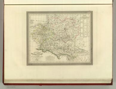
Carte Generale du Royaume de Polonge.
1 : 4400000 Vivien de St Martin, L.
Das Königreich Pohlen und Grosherzogthum Litthauen
Litva
Generalkarte von Polen, Litauen und den angrenzenden Ländern
Polen-Litauen Schraembl, Franz Anton
Poland, Lithuania
1 : 2650000 Lizars, Daniel
Kriegskarte des Koenigreichs Polen, nach den bewährtesten Hülfmitteln und den Theilungs-Tractaten vom Jahre 1773 und 1793 entworfen
1 : 2250000 entw. u. gest. von F. X. Hutter Augsburg : zu haben bey Joh. Walch
Polen vor der Theilung
1 : 1800000 Polsko Goldschmidt Goldschmidt
Polens Umwandelungen von 1772-1809
1 : 2100000 Bělorusko in der Dykischen Buchhandlung
Generalkarte von Polen, Litauen und den angraenzenden Laendern
1 : 1250000 Litva Follin, Bartolomeo F.A. Schraembl
Het Koningkryk Polen, volgens de nieuwste waarneminge opgesteld
1 : 16000000 te Amsterdam : bij S. v. Esveldt
Nova descriptio regni Poloniae et magni ducatus Lithuaniae
1 : 6600000 Litva
Polens Umwandelungen von 1772-1809
1 : 2100000 Polsko zu finden in der Dykischen Buchhandlung
Zweite Theilung Polens 1793
Polen Teilung Polens <1793>
Erste Theilung Polens 1772
Polen Teilung Polens <1772>
Zweite Theilung Polens 1793
Polen Teilung Polens <1793>
Polen, nach seiner ersten und letzten, oder gänzlichen Theilung
1 : 2500000 entw. u. gest. von F. X. Hutter Augsburg : zu haben bey Joh. Walch
Erste Theilung Polens 1772
Polen Teilung Polens <1772>
Paasche's Frontenkarte, Nr.6. Der Krieg gegen Russland

Charte von Polen
1 : 2300000 Bělorusko Kipferling, Karl Joseph Artaria
Poloniae finitimarumque locorum descriptio. [Karte], in: Theatrum orbis terrarum, S. 103.
1 Karte aus Atlas Ortelius, Abraham
Poland.
1 : 6400000 Seaman, James V.
Poland, Lithuania.
1 : 2600000 Cary, John, ca. 1754-1835
Poland: Natural increase
1 : 3000000 Series of maps on various aspects of Poland. Natural increase. Annual increase of population. War Office

Charte vom Koenigreich Polen
1 : 2090000 Bělorusko Hutter, F. X. Walch, Johann bey Joh. Walch
(La Pologne)
1 : 13000000 Bruyset, Jean-Marie; Schneider, J. H.
Dritte Theilung Polens 1795
Polen Teilung Polens <1795>
Carte ethnographique des Russes, Polonais et Luthuaniens
1 : 1680000 Litva Florinskij, Timofej Dmitrijevič
Estats de la couronne de Pologne
1 : 2800000 Evropa východní Jaillot, Alexis-Hubert H. Jaillot
ESTATS DE LA COURONNE DE POLOGNE
1 : 2800000 Evropa východní Jaillot, Alexis-Hubert H. Jaillot
Mappa geographica regnorum Poloniae et Prussiae magnique ducatus Lithuaniae unacum provincia Russia rubra
1 : 2900000 Bělorusko Lidl, Joseph Anton Mayer, Tobias ab Josepho Antonio Lidl