Maps of New York

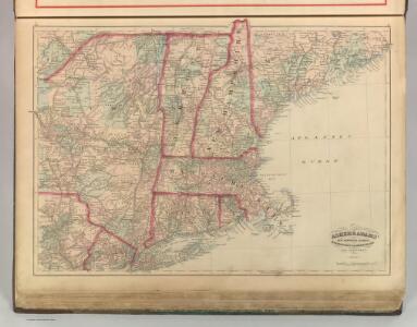
New Hampshire, Vermont, Massachusetts, Rhode Island, and Connecticut.
1 : 1270000 Asher & Adams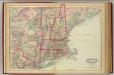
N.H., Vt., Mass., R.I., Conn.
1 : 1267200 Asher & Adams
Railroad map of New England & eastern New York : compiled from the most authentic sources
1 : 700000 Goldthwait, J. H Redding & Co. ; Clark, Austin & Co.
Map of New England exhibiting the rail and telegraphic lines now in operation
Brown & Hastings Coolidge & Wiley
Map of the northern, or, New England states of America, comprehending Vermont, New Hampshire, District of Main, Massachusetts, Rhode Island, and Connecticut

New Engelland, New York, New Yersey und Pensilvania

An exact map of New England, New York, Pensylvania & New Jersey, from the latest surveys / J. Lodge, sculp.
from Parts
Carte de la Nouvelle Angleterre: New York, Pensilvanie et Nouveau Jersay suivant les cartes angloises.
from John H. Levine Collection Bellin: [Paris]; Bellin, Jacques Nicolas,
New England.
from A new systeme of the mathematicks: containing I. Arithmetick, as well natural and decimal, as in species, or the principles of algebra. II. Practical geometry, together with the first six books of Euclid's Elements, as also the eleventh and twelfth, symbo
Railway map New England States.
1 : 1175000 George K. Snow & Bradlee
Railway map New England States.
1 : 1175000 George K. Snow & Bradlee
Scene of Operations of the Northern Army.
1 : 1950000 Marshall, John
New England, Eastern New York.
1 : 805000 Rand McNally and Company
E. United States 2.
1 : 1774080 Letts, Son & Co.
A new and accurate map of New Jersey, Pensilvania, New York and New England: with the adjacent countries / drawn from surveys, assisted by the most approved modern maps & charts and regulated by astronomical observations by Eman. Bowen.
from Charts and maps Emannuel Bowen,
New England States.
1 : 520000 Hale, Nathan
New England States.
1 : 520000 Hale, Nathan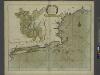
A large draught of New England, New York and Long Island.
from The sea-atlas : containing an hydrographical description of most of the sea-coasts of the known parts of the world.
Vermont, Massachusetts, Rhode Island, and Connecticut.
1 : 4384000 Fisher, Richard Swainson
A Map of the New England States.
1 : 520000 Hale, Nathan
Carte du théatre de la guerre entre les Anglais et les Américains
1 : 1400000 Nová Anglie Brion de la Tour, Louis Esnauts et Rapilly
Mappa geographica Provinciae Novae Eboraci ab Anglis New-York dictae / ex ampliori delineatione ad exactas dimensiones concinnata in arctius spatium redacta cura Claudii Josephi Sauthier cui accedit Nova Jersey ex topographicis observationibus.
from Charts and maps Claude Joseph Sauthier,
New England.
1 : 2550000 Huntington, Nathaniel G. (Nathaniel Gilbert), 1785-1848
Telegraph and rail road map of the New England states

Williams' telegraph and rail road map of the New England states, eastern portion of New York state and Canada

N.Y., Vt., Maine, N.H., Mass., Conn., R.I., N.J.
1 : 1770000 Society for the Diffusion of Useful Knowledge (Great Britain)
Portland & Ogdensburg Railroad and connections.
1 : 4055000 Portland & Ogdensburg Railroad Company
Eastern States.
1 : 2400000 D.F. Robinson & Co.
Map of New England with adjacent portions of New York & Canada
1 : 1537500 Walling, Henry Francis Walling, Henry Francis