Maps of Virginia
Virginia, Maryland, Delaware.
1 : 760320 Colton, J. H.
A map of the state of Virginia reduced from the nine sheet map of the state, in conformity to law / by Herman Böye ; engraved by H.S. Tanner and E.B. Dawson.
from Virginia
Virginia, Delaware, Maryland, and West Virginia.
1 : 1520000 Johnson, A.J.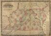
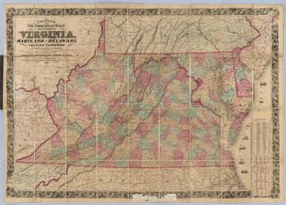
Colton's New Topographical Map of the States of Virginia, Maryland and Delaware
Colton's New Topographical Map of the States of Virginia, Maryland and Delaware, showing also Eastern Tennessee and parts of other adjoining States, all the Fortifications, Military-Stations, Rail-Roads, Common Roads and other internal improvements. Colton’s New Topographical Map of the States of Virginia, Maryland and Delaware, along with parts of Eastern Tennessee and ‘other adjoining states’ was published in 1862 by the New York-based J.H. Colton. The state is divided by county, with a breakdown of area per square mile on the right hand side. Colton was one of the foremost map publishers in American during the 19th century. The majority were coloured to divide the states and individual counties and covered numerous scales, from pocket maps to large atlases. The publishing company also reproduced maps by other publishers. Colton maps are highly valued for their accuracy and detailing and are held by numerous collections across America and the rest of the world. J.H. Colton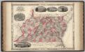
Virginia, Delaware, Maryland, and West Virginia.
1 : 1487000 Johnson, A.J.
Delaware, Maryland, Virginia, West Virginia, District of Columbia
1 : 1280000 Asher & Adams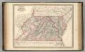
Virginia, Delaware, Maryland, and West Virginia.
1 : 1520000 Johnson, A.J.
Virginia, Delaware, Maryland, and West Virginia.
1 : 1520000 Johnson, A.J.
Virginia.
from Charts and maps Published by F. (Fielding) Lucas Jr.: Baltimore,
Virginia.
1 : 1647360 Carey, Mathew
State of Virginia.
1 : 1647360 Carey, Mathew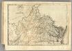
State of Virginia.
1 : 1622000 Lewis, Samuel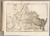
State of Virginia.
1 : 1647360 Carey, Mathew
The state of Virginia: from the best authorities / by Samuel Lewis, 1794.; Notes on the state of Virginia. With an appendix. By Thomas Jefferson.
from Notes on the state of Virginia. With an appendix. By Thomas Jefferson. Jefferson, Thomas,
Virginia, Maryland, and Delaware / by H.S. Tanner.
from Parts
Eastern U.S.
1 : 2750000 Cornell, S. S. (Sarah S.)
Map of the state of Virginia / constructed in conformity to law from the late surveys authorized by the Legislature and other original and authentic documents, by Herman Böye ; engraved by H.S. Tanner ; title, writn. & engrd. by Jos. Perkins.
from Virginia
Virginia
1 : 1900000 Annotatie: Gerestaureerd en op Japans papier geplakt New York, [N.Y.] : J.H. Colton & Co.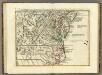
Il Maryland, il Jersey Meridionale, la Delaware.
1 : 2100000 Zatta, Antonio
The tourist's pocket map of the state of Virginia : exhibiting its internal improvements, roads, distances, &c. / by J.H. Young ; engraved by E. Yeager & F. Dankworth.
from Virginia
Virginia.
1 : 2000000 Colton, G.W.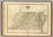
Virginia, Maryland, Delware.
1 : 1120000 Tanner, Henry S.
Schonberg's Map of Virginia and West Virginia.
1 : 1900000 Schonberg & Co.
Virginia.
1 : 2550000 Finley, Anthony
County map of Virginia and West Virginia.
from New general atlas.
Virginia, Maryland, and Delaware / by H.S. Tanner.
from Charts and maps
Virginia.
1 : 2500000 Tanner, Henry S.
The state of Virginia : from the best authorities / by Samuel Lewis, 1794 ; Smither, sculpt.
from Notes on the State of Virginia. By Thomas Jefferson.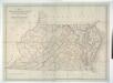
Map of Virginia, Maryland and Delaware exhibiting the post offices, post roads, canals, rail roads &c. / by David H. Burr, (Late topographer to the Post Office,) Geographer to the House of Representatives of the U.S.
from Parts David H. Burr,