Maps of United Kingdom

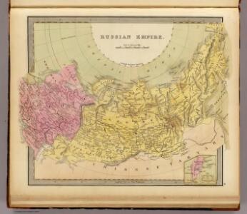
Russian Empire.
1 : 21000000 Greenleaf, Jeremiah
Russian Empire.
1 : 21000000 Greenleaf, Jeremiah
England, Scotland & Ireland, with the iles thereto belonging.
from A new systeme of the mathematicks: containing I. Arithmetick, as well natural and decimal, as in species, or the principles of algebra. II. Practical geometry, together with the first six books of Euclid's Elements, as also the eleventh and twelfth, symbo
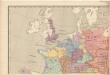
Europe 1.
1 : 3850000 Brue, Adrien Hubert, 1786-1832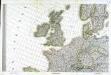
Carte d'Europe ou sont tracées les limites des empires, royaumes, et etats souverains, feuille 3
1 Blatt : 65 x 95 cm Semen etc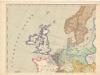
Evropa XIX. století: od vídeňského kongresu r. 1815, do rozhodnutí na frontách světové války r. 1918
Kašpar, Jan
Carte de la marche des Burgondes
Europa Burgunden Völkerwanderungszeit
Evropa, 1
1 Blatt : mehrfarbig ; 49 x 57 cm Homännische Erben
L'ocean pres d'Europe
1 Karte : Kupferdruck ; 46 x 34 cm Duval chez l'auteur
Westeuropa 1812
Westeuropa Kunz, Andreas ; Treiling, Thomas
Westeuropa 1797
Westeuropa Kunz, Andreas ; Treiling, Thomas
Westeuropa 1830
Westeuropa Kunz, Andreas ; Röss, Wolf ; Johnen, Bettina ; Moeschl, Joachim Robert
Westeuropa 1949
Westeuropa Kunz, Andreas ; Treiling, Thomas
Westeuropa 1890
Westeuropa Kunz, Andreas ; Röss, Wolf ; Johnen, Bettina ; Moeschl, Joachim Robert
Westeuropa 1937
Westeuropa Kunz, Andreas ; Treiling, Thomas
Westeuropa 1914
Westeuropa Kunz, Andreas ; Röss, Wolf ; Johnen, Bettina ; Moeschl, Joachim Robert
Westeuropa 1871
Westeuropa Kunz, Andreas ; Röss, Wolf ; Johnen, Bettina ; Moeschl, Joachim Robert
Westeuropa 1789
Westeuropa Kunz, Andreas ; Treiling, Thomas
Westeuropa 1848
Westeuropa Kunz, Andreas ; Röss, Wolf ; Johnen, Bettina ; Moeschl, Joachim Robert
Westeuropa 1867
Westeuropa Kunz, Andreas ; Röss, Wolf ; Johnen, Bettina ; Moeschl, Joachim Robert
Westeuropa 1861
Westeuropa Kunz, Andreas ; Röss, Wolf ; Johnen, Bettina ; Moeschl, Joachim Robert
Westeuropa 1957
Westeuropa Kunz, Andreas ; Treiling, Thomas
Westeuropa 1990
Westeuropa Kunz, Andreas ; Treiling, Thomas
Westeuropa 1820
Westeuropa Kunz, Andreas ; Röss, Wolf ; Johnen, Bettina ; Moeschl, Joachim Robert
Westeuropa 1922
Westeuropa Kunz, Andreas ; Treiling, Thomas
Westeuropa 1839
Westeuropa Kunz, Andreas ; Röss, Wolf ; Johnen, Bettina ; Moeschl, Joachim Robert
Westeuropa 1935
Westeuropa Kunz, Andreas ; Treiling, Thomas
Westeuropa 2003
Westeuropa Kunz, Andreas ; Treiling, Thomas
Tabula Nova Hibernie Anglie Et Scotie [Karte], in: Claudii Ptolemei viri Alexandrini mathematice discipline philosophi doctissimi geographie opus [...], S. 236.
1 Karte aus Atlas Waldseemüller, Martin [und Ptolemaeus, Claudius] Übelin, Georg