Project
Community
News
My maps
Cataloged map
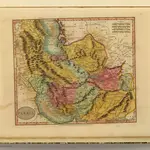
Persia.
Full title:
Persia.
Publisher:
William Darton
Physical Size:
20 x 30 cm
Map scale:
1:8 100 000
History