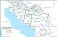
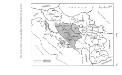
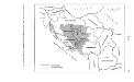
Maps of Dinaric Alps

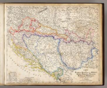
Kroatien, Slavonien, Militair-Granze, Dalmatien, Bosnien, Serbien, Montenegro.
1 : 1673850 Handtke, Friedrich H.
Le pays des Serbes, des Croates et des Slovenes
Jugoslawien Physische Geografie
Überfall, Besatzung und Teilung Jugoslawiens 1941
Jugoslawien Balkanfeldzug <1941>, Besetzung
Les Serbes, les Croates et les Slovènes parmi les nations-voisines
Serbien Kroatien
SFR Jugoslawien 1945-1991
Jugoslawien Džambo, Jozo
Exactissima tabula qua tam Danubii fluvii pars media, ab urbe lentiae ad Bydenam urbem et minores in eum influentes fluvii, quam regiones adjacentes ut Hungaria, Slavonia, Croatia, Bosnia, Dalmatia, Servia, nec non Germaniae, Poloniae, et Graeciae confinia ostenduntur
1 : 1750000 Bosna Visscher, Nicolaus N. Visscher
Artaria ́s Handkarte des Königreiches der Serben, Kroaten und Slovenen

Jugoslávie

Velika zidna karta Srba, Hrvata i Slovenaca
Politische Aufteilung des Königreichs SHS auf Gebiete (oblasti) 1922
Kraljevina Srba, Hrvata i Slovenaca Verwaltungsgliederung Džambo, Jozo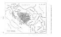
Politische Aufteilung des Königreichs Jugoslawien auf Banschaften 1929
Jugoslawien Verwaltungsgliederung Džambo, Jozo
Nova et Accurata Hungariae cum Adiacentib. Regn. et Principatibus Tabula aeri incisa et venum exposita
1 : 2100000 Mollova mapová sbírka Seutter, Matthäus Seutter, Matthäus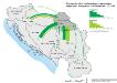
Binnenmigration im ehemaligen Jugoslawien: Vojvodina - Immigration und Emigration 1971-1981
Wojwodina Binnenwanderung Hofinger, Veronika
Hungaria Seraphico-Observans
1 : 2100000 Mollova mapová sbírka Seutter, Matthäus Lotter, Elias Tobias
Handkarte des Jugoslawischen Reiches
1 : 1500000 Evropa jihovýchodní Ed. Hölzel
Exactissima Tabula, qua tam Danubii Fluvii Pars Media
1 : 2100000 Mollova mapová sbírka Visscher, Nicolaes Jansz. Visscher, Nicolaus
Exactissima Tabula, qua tam Danubii Fluvii Pars Media
1 : 2100000 Mollova mapová sbírka Visscher, Nicolaes Jansz. Visscher, Nicolaus
Politische Aufteilung des Königreichs Jugoslawien auf Banschaften 1931
Jugoslawien Verwaltungsgliederung Džambo, Jozo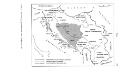
Zerstückelung Jugoslawiens nach der Okkupation 1941
Jugoslawien Balkanfeldzug <1941>, Besetzung Džambo, Jozo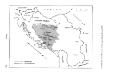
Banschaft Kroatien im Königreich Jugoslawien 1939
Jugoslawien, Kroatische Banschaft Džambo, Jozo
Novißima et accuratißima Hungariae cum circumjacentibus regnis et principatibus in mappa geographica designatio
1 : 2000000 Evropa jihovýchodní Seutter, Matthäus Probst, Johann Michael Ioh. Mich. Probst
Novißima et accuratißima Hungariae
1 : 2000000 Balkánský poloostrov Seutter, Matthäus M. Seutter
Nova et accurata Hungariae
1 : 2000000 Balkánský poloostrov Seutter, Matthäus M. Seutter
Novißima et accuratißima Hungariae cum circumjacentibus regnis et principatibus in mappa geographica designatio
1 : 2000000 Evropa jihovýchodní Seutter, Matthäus impensis Matthaei Seutteri
Nova et accurata Hungariae cum adiacentib. regn. et principatibus tabula
1 : 2000000 Evropa jihovýchodní Seutter, Matthäus a Matth. Seuttero
Jugoslawien
Jugoslawien ethnische Gruppe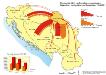
Binnenmigration im ehemaligen Jugoslawien: Vojvodina - Immigration und Emigration 1953-1981
Wojwodina Binnenwanderung Hofinger, Veronika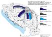
Vojvodina - Immigration und Emigration von Serben und sonstigen ethnischen Gruppen im Vergleich bis 1981
Wojwodina Migration, ethnische Gruppe Hofinger, Veronika