Maps of Punjab

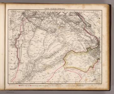
Der Sikh-Staat.
1 : 2200000 Flemming, Carl
The Panjab with Part of Afganistan, Kashmeer, Sinde & c
1 : 2200000 Afghánistán Walker, John Walker, Alexander Society for the Diffusion of Useful Knowledge
India 12.
1 : 2217600 Letts, Son & Co.
Panjab, Afghanistan, Kashmeer, Sinde &c.
1 : 2200000 Society for the Diffusion of Useful Knowledge (Great Britain)
136. Punjab. Calcutta. Bombay. The World Atlas.
1 : 2500000 USSR (Union of Soviet Socialist Republics).
Partie du Caboul. Asie 67.
1 : 1641836 Vandermaelen, Philippe, 1795-1869
Partie du Thibet. Asie 68.
1 : 1641836 Vandermaelen, Philippe, 1795-1869
India 11.
1 : 2217600 Letts, Son & Co.
India XI.
1 : 2200000 Society for the Diffusion of Useful Knowledge (Great Britain)
India 9.
1 : 2217600 Letts, Son & Co.
India IX.
1 : 2200000 Society for the Diffusion of Useful Knowledge (Great Britain)
Uebersicht des gegenwärtigen Kriegsschauplatzes in Indien
1 : 1200000 [S.l.] : [s.n.]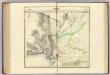
Beloutchistan. Asie 81.
1 : 1641836 Vandermaelen, Philippe, 1795-1869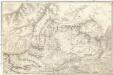
Kafiristan
1 : 257000 Afghánistán Surveyor general's office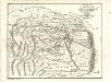
Charte von Kaschemir: Aus einer in der Nationalbibliothek zu Paris von Capt. Gentil niedergelegten Beschreibung Hindostan's
Landes-Industrie-Comptoir
[Suharunpoor]
Indie Surveyor general's office
Punjab, Punjab States, No 44I
This range contains maps acquired by, or transferred to, the India Office Library and Records in the FCO between 15 August 1947 and 31 December 1973. Items acquired by gift or purchase, in common with all such acquisitions of books and private paper Survey of India
Geognostische Skizze des Erzgebirges von Uspallata.
1 : 555555 Uspallata (Argentina) Burmeister, Hermann Reimer, Dietrich Dietrich Reimer
Punjab & Punjab States, No 44 I/16
India And Adjacent Countries 1:63,360 or 1" = 1 mile maps Survey of India
Punjab, No 44 I/8
India And Adjacent Countries 1:63,360 or 1" = 1 mile maps Survey of India
Punjab, No 44 I/7
India And Adjacent Countries 1:63,360 or 1" = 1 mile maps Survey of India
Lahore Guide Map
India Office reference collection of maps Survey of India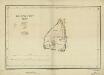
Lahore Fort
India Office reference collection of maps Survey of India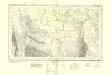
Sind Survey, Sheet No 26
India Office reference collection of maps Survey of India
Upper Swat and adjacent hill tracts
An archæological tour in Upper Swāt and adjacent hill tracts. Stein, Aurel, Sir, 1862-1943. Calcutta
Cabool, The Punjab and Beloochistan.
1 : 6969600 Tallis, J. & F.
Punjab, Afghanistan
Tallis's Illustrated Atlas, and Modern History of the World, Geographical, Political, Commercial, and Statistical. Edited by R. Montgomery Martin. London : John Tallis and Co.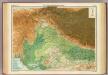
India - north-western section.
1 : 4000000 John Bartholomew & Co.
Induslander.
1 : 4000000 Kiepert, Heinrich, 1818-1899