Project
Community
News
My maps
Cataloged map
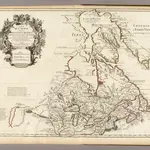
Canada, Nouvelle France.
Full title:
Canada, Nouvelle France.
Publisher:
Guillaume De L'Isle, Quai de l'Horloge a l'Aigle d'Or
Physical Size:
20 x 30 cm
Map scale:
1:9 000 000
History