Maps of Swabia

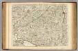
Composite: Souabe.
1 : 240000 L'Isle, Guillaume de, 1675-1726
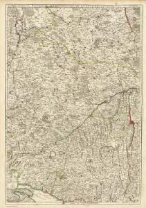
Composite: Souabe.
1 : 240000 L'Isle, Guillaume de, 1675-1726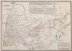
Retraite de Bavière en France, Faite par l'Armée française de Rhin et Moselle, sous les ordres du Général Moreau, Depuis le 10 Septembre jusqu'au 26 Octobre 1796
Haas, Wilhelm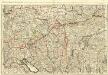
Le Cours du Danube
1 : 440000 Mollova mapová sbírka Jaillot, Alexis-Hubert Jaillot, Alexis Hubert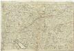
Le cours du Danube, depuis sa source jusques a Straubing
1 : 490000 Bavorsko (Německo) Jaillot, Alexis-Hubert
Le Cercle de Souabe et partie de Celuy de Franconie
1 : 600000 Mollova mapová sbírka Fer, Nicolas de Inselin, Charles Fer, Nicolas de
Geographica Sueviæ universæ descriptio, 4
2 Blätter : Homännische Erben
Le cercle de Baviere
1 Karte : Kupferdruck ; 47 x 57 cm Sanson chez I. Cóvens et C. Mortier
Sveviae nova tabvla
1 : 880000 Švábsko (Německo) Blaeu, Willem Janszoon apud Guiljelmus Blaeuw
Ducatus Wurtenbergensis
1 : 380000 Mollova mapová sbírka Visscher, Nicolaes Gouwen, Giliam van der Schenk, Peter II
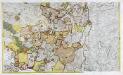
Le Cercle de Baviere
1 : 575000 Mollova mapová sbírka Mortier, Pieter Covens, Johannes I
Special Post Karte durch den schwaebischen Kreis
1 Karte : Kupferdruck ; 43 x 53 cm Homännische Erben
Special Post Karte durch den schwaebischen Kreis
1 Karte : Kupferdruck ; 43 x 54 cm Homännische Erben
Special Post Karte durch den schwaebischen Kreis
1 Karte : Kupferdruck ; 43 x 54 cm Homännische Erben
Les Cours de Postes par le Cercle de Suabe, come ils se presentent dans la Carte Geographique
1 : 130000 Mollova mapová sbírka Homann, Johann Baptist Homann, Johann Baptista - dědici
Sacri Imperii Romani Circuli et Electoratus Bavariae cum Finitimis Geographica Descriptio. Cum Privilegio D.D. Ordinum Generalium ut et Hollandiae West Frisiaequae]
1 : 270000 Mollova mapová sbírka Valck, Leonardus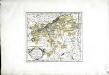
Die Markgrafschaft Burgau mit den Grafschaften Kirchberg und Weissenhorn
1 Karte : Kupferdruck ; 21 x 23 cm Reilly F. J. J. von Reilly
Königreich Bayern
Grosser Hand-Atlas über alle Theile der Erde in 170 Karten Meyer, J. Verlag des Bibliographischen Instituts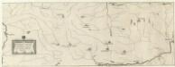
Conjuctio Danubij cum Meno, aut alijs vicinis Fluvijs
Mollova mapová sbírka Vogemont, Lothar
Freytag & Berndt ́s: Auto-Strassenkarten

Ducatus Wurtenbergici, 2
1 Blatt : Johann Baptist Homann
Partie septentrionale de la Souabe
1 Karte : Kupferdruck ; 46 x 62 cm L'Isle; Renard chez l'auteur sur le quai de l'Horloge, chez L. Renard libraire prez de la bourse
Bayern III.
1 : 650000 Radefeld, Carl Christian Franz, 1788-1874
Totius S. R. I. Circuli Suevici Tabula Chorographica
1 : 310000 Mollova mapová sbírka Lamsvelt, Jan Ottens, Josua
Pars Sueviae australior
1 : 310000 Württembersko (Německo) Delisle, Guillaume Lotter, Tobias Conrad T. C. Lotter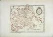
Das Herzogthum Würtemberg
1 Karte : Kupferdruck ; 23 x 30 cm Reilly F. J. J. von Reilly
Partie meridionale de la Souabe
1 Karte : Kupferdruck ; 46 x 65 cm L'Isle; Ottens; Ottens chez R. et I. Ottens geogr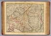
Souabe Meridionale
1 : 240000 L'Isle, Guillaume de, 1675-1726