Maps of Plaquemines Parish
The Coast of West Florida and Louisiana.
1 : 1560000 Jefferys, Thomas
East and West Florida.
1 : 4181760 Morse, Jedidiah
Embouchure du Mississipi. Amer. Sep. 61.
1 : 1641836 Vandermaelen, Philippe, 1795-1869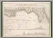
Floride, Delta du Mississippi canal.
1 : 1700000 Poussin, Guillaume Tell, 1794-1876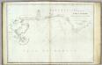
The coasts of West Florida, Alabama, Mississippi & Louisiana.
1 : 680000 Gauld, George.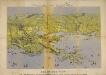
Panorama of the Seat of War. Bird's-eye View of Louisiana, Mississippi, Alabama and part of Florida. Drawn from nature by J. Bachmann.
Panorama of the Seat of War. Bird's-eye View of Louisiana, Mississippi, Alabama and part of Florida. Drawn from nature by J. Bachmann. This 1861 map presents a ‘Bird’s Eye View’ of the Gulf region around Louisiana, Mississippi, Alabama and the edge of Florida. Drawn and published by John Bachmann, the map details numerous strategic forts around this region, including Forts Pickens, Phillip and Jackson, as well as the city of New Orleans. The map highlights how important water routes and control of coastal defences were by both sides during the conflict.
Map of the province of West Florida
1 : 2450000 Kitchin, Thomas Baldwin, Richar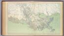
Gen. map XXI.
1 : 633600 United States. War Department
Map of New Orleans and Adjacent Country.
1 : 696960 Melish, John
Map of New Orleans and Surrounding Country.
New York Herald
Map of New Orleans and Adjacent Country.
1 : 625000 Melish, John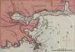
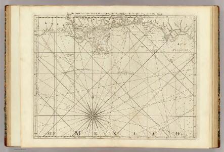
Lloyd's Military Campaign Charts: New Orleans - Mouth of Mississippi
Lloyd's Military Campaign Charts, showing the principal places of interest, compiled from official data by Gen. E.L. Viele and C. Haskins. Published under the auspices of the American Geographical and Statistical Society. New Orleans - Mouth of Mississippi.
Prang's Naval Expedition Maps: the Lower Mississippi, New Oreans, and vicinity
Prang's Naval Expedition Maps: the Lower Mississippi, New Oreans, and vicinity L. Prang & Co.
Baies, Florides, Golfe du Mexique.
1 : 65000 Poussin, Guillaume Tell, 1794-1876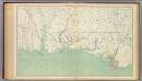
Gen. map XII.
1 : 633600 United States. War Department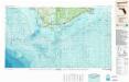
Apalachicola
1 : 250000
Apalachicola
1 : 250000
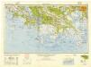
New Orleans
1 : 250000
New Orleans
1 : 250000
New Orleans
1 : 250000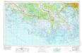
New Orleans
1 : 250000
New Orleans
1 : 250000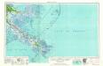
Breton Sound
1 : 250000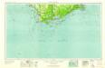
Apalachicola
1 : 250000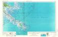
Breton Sound
1 : 250000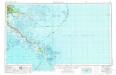
Breton Sound
1 : 250000
Breton Sound
1 : 250000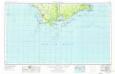
Apalachicola
1 : 250000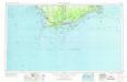
Apalachicola
1 : 250000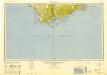
Apalachicola
1 : 250000