Maps of United States
Map of the United States.
1 : 9800000 H.W. Burgett and Company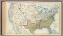
USA June 1861.
1 : 6900000 Julius Bien & Co.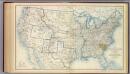
USA Dec. 1860.
1 : 6900000 Julius Bien & Co.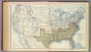
USA Dec. 1861.
1 : 6900000 Julius Bien & Co.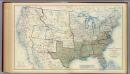
USA June 1862.
1 : 6900000 Julius Bien & Co.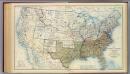
USA Apr. 1865.
1 : 6900000 Julius Bien & Co.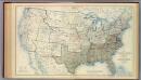
USA Dec. 1862.
1 : 6900000 Julius Bien & Co.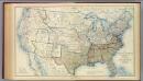
USA June 1863.
1 : 6900000 Julius Bien & Co.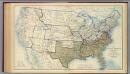
USA June 1864.
1 : 6900000 Julius Bien & Co.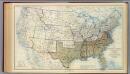
USA Dec. 1864.
1 : 6900000 Julius Bien & Co.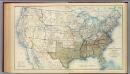
USA Dec. 1863.
1 : 6900000 Julius Bien & Co.
Index Map: United States of America.
1 : 14495100 Colton, J. H.
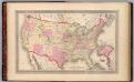
United States of America.
1 : 14495100 Colton, J. H.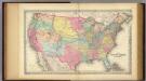
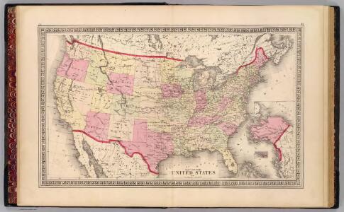
The United States Of America.
1 : 7920000 Colton, G.W.
Turn and learn, U.S.
1 : 25000000 Chartomap Co.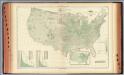
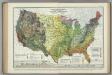
99. Wheat per sq. mile.
1 : 8900000 Gannett, Henry, 1846-1914; Hewes, Fletcher W.; United States. Census Office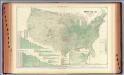
96. Farm land by counties.
1 : 8900000 Gannett, Henry, 1846-1914; Hewes, Fletcher W.; United States. Census Office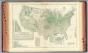
98. Corn per acre planted.
1 : 8900000 Gannett, Henry, 1846-1914; Hewes, Fletcher W.; United States. Census Office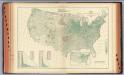
101. Oats per sq. mile.
1 : 8900000 Gannett, Henry, 1846-1914; Hewes, Fletcher W.; United States. Census Office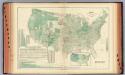
100. Wheat per acre sown.
1 : 8900000 Gannett, Henry, 1846-1914; Hewes, Fletcher W.; United States. Census Office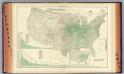
97. Corn per sq. mile.
1 : 8900000 Gannett, Henry, 1846-1914; Hewes, Fletcher W.; United States. Census Office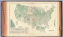
102. Oats per acre sown.
1 : 8900000 Gannett, Henry, 1846-1914; Hewes, Fletcher W.; United States. Census Office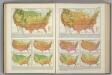
Monthly Temperature Maps: March. April. Atlas of American Agriculture.
Kincer, Joseph Burton
Average Velocity of Wind ... Prevailing Direction of Surface Winds... Atlas of American Agriculture.
Kincer, Joseph Burton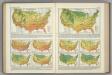
Monthly Temperature Maps: November. December. Atlas of American Agriculture.
Kincer, Joseph Burton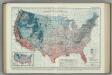
Average Dates of First Killing Frosts in Fall. Atlas of American Agriculture.
1 : 8000000 Brooks, Charles Franklin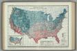
Average Dates of Last Killing Frost in Spring. Atlas of American Agriculture.
1 : 8000000 Reed, William Gardner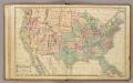
United States.
1 : 9700000 Cornell, S. S. (Sarah S.)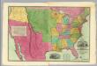
Map Of The United States Of America.
1 : 4118400 Willard, A.