Project
Community
News
My maps
编目地图
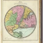
Map of the Country Twenty Five Miles Round The City Of New-York.
完整标题:
Map of the Country Twenty Five Miles Round The City Of New-York.
出版商:
D.S. Stone
物理尺寸:
20 x 30 cm
地图比例尺:
1:211 200
历史