Maps of Seven Seas (Open Ocean)
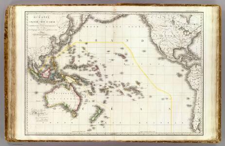
Oceanie.
1 : 29500000 Brue, Adrien Hubert, 1786-1832
Oceana Or Pacific Ocean.
1 : 55000000 Tanner, Henry S.
Oceana Or Pacific Ocean.
1 : 55000000 Tanner, Henry S.
Oceana Or Pacific Ocean.
1 : 57500000 Mitchell, Samuel Augustus
Pacific.
1 : 75000000 Andree, Richard; Times (London, England)
Grosser Ocean.
1 : 75000000 Andree, Richard
Composite: Oceanie.
1 : 15500000 Brue, Adrien Hubert, 1786-1832
Oceana or Pacific Ocean.
1 : 54000000 Tanner, Henry S.
Pacific Ocean
1 : 35000000 Aleutské ostrovy (Aljaška) National Geographic Society
Pacific Ocean including Oceania.
1 : 47000000 Mitchell, Samuel Augustus
Pacific Ocean including Oceania.
1 : 47000000 Mitchell, Samuel Augustus
Pacific Ocean.
1 : 35000000 Arrowsmith, John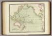
Pacific Ocean.
1 : 55000000 Teesdale, Henry
Africa
1 : 6500000 Arrowsmith, Aaron, 1750-1823 A. Arrowsmith, Rathbone Place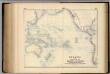
Oceania, or Islands in the Pacific Ocean.
1 : 41000000 Fullarton, A. & Co.
Pacific Ocean.
1 : 50000000 Letts, Son & Co.
Pacific Ocean.
1 : 90000000 Arrowsmith, Aaron; Lewis, Samuel
Oceanica, Sandwich Islands.
1 : 70000000 Mitchell, Samuel Augustus
Oceanica, Sandwich Islands.
1 : 70000000 Mitchell, Samuel Augustus
Oceanica, Sandwich Islands.
1 : 70000000 Mitchell, Samuel Augustus Jr.
Oceanica, Sandwich Islands.
1 : 70000000 Mitchell, Samuel Augustus
Oceanica, Sandwich Islands.
1 : 70000000 Mitchell, Samuel Augustus
Map Of Oceanica.
1 : 100000000 Mitchell, Samuel Augustus
Pacific Ocean. Pergamon World Atlas.
Polish Army Topography Service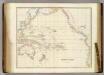
Pacific Ocean.
1 : 40000000 Arrowsmith, John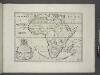
A new map of Africk shewing its present general divisions, chief cities or towns, rivers, mountains &c.
from A new sett of maps both of antient and present geography : wherein not only the latitude and longitude of many places are corrected according to the latest observations, but also the most remarkable differences of antient and present geography may be quickly discern'd by a bare inspection or comparing of correspondent maps, which seems to be the most natural and easy method to lead young students (for whose use the work is principally intended) unto a competent knowledge of the geographical science : together with a geographical treatise particularly adapted to the use and design of these maps / by Edward Wells, M.A. and student of Christ-Church, Oxon.
Africa according to the best authorities.
from Carey's general atlas, improved and enlarged : being a collection of maps of the world and quarters, their principal empires, kingdoms, &c.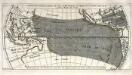
Répresentation du cours ordinaire des vents de traverse qui regnent sur les côtes dans la grande mer du Sud
1 Karte : Kupferdruck ; 15 x 30 cm Cosmant Didot
Pacific Ocean.
1 : 50000000 Society for the Diffusion of Useful Knowledge (Great Britain)