Maps of Mali
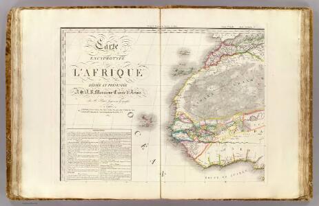
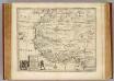
L'Afrique 1.
1 : 10000000 Brue, Adrien Hubert, 1786-1832
West Africa.
1 : 15000000 Colton, G.W.

Carte de la Barbarie, le la Nigritie et de la Guinée
1 : 9375000 par Guillaume de L'Isle de l'Academie Royale des Sciences [S.l.] : [s.n.]
West Africa.
1 : 18000000 Arrowsmith, Aaron; Lewis, Samuel
West Africa.
1 : 18000000 Arrowsmith, Aaron; Lewis, Samuel
Carte d'une parte de l'Afrique
1 : 5860000 Afrika severozápadní Lapie, Pierre
Archipelagus atlanticus cum suis insulis Canariis, Hesperidibus et Azoribus
1 : 1
West Africa.
1 : 15000000 Colton, G.W.
Nordwestliches Afrika
Negroland, adjacent countries.
1 : 10000000 Bowen, Emanuel
Africa NW.
1 : 10000000 Andree, Richard; Times (London, England)
Afrique du N.O.
1 : 10000000 Vivien St Martin, L.
167-168. Africa, West. The World Atlas.
1 : 7500000 USSR (Union of Soviet Socialist Republics).
Conjecturale de l'Atlantide.
1 : 11000000 Vincent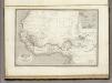
Afrique Occidentale.
1 : 2700000 Montemont, A.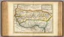
Negroland and Guinea.
1 : 15000000 Moll, Herman, d. 1732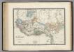
Senegambie, Soudan, Guinee.
1 : 8600000 Levasseur, E.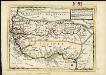
Negroland and Guinea, with the European settlements explaining what belongs to England, Holland, Denmark &c.
1 : 12500000
Partie occidentale de l'ancien continent depuis Lisbonne jusquà la Riviere de Sierra Leona, avec l'Isle Madere, les Isles Canaires, et celles du C. Verd
1 : 11500000
Spezial - karte von AfricaSektion West-Sahara (1)
1 : 4000000 1 full d'1 mapa en 10 fulls i estoig Hermann Habenicht; Justus Perthes
Spezial-Karte von Afrika
1 : 4000000 Blatt 1 Habenicht, Hermann Perthes
Spezial - karte von AfricaSektion West-Sudân (4)
1 : 4000000 1 full d'1 mapa en 10 fulls i estoig Hermann Habenicht; Justus Perthes
Karte von der westlichen kuste von Africa : von der strasse bey Gibraltar bis zu dem XI grade norderbreite ...wahrnehmungen entworfen
1 : 1
A chart of the western coast of Africa, from the Straits of Gibraltar to eleven degrees of north latitude, including the Canary & Cape Verd Islands
1 : 13000000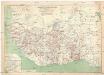
Carte touristique de l'Afrique occidentale française
1 : 3000000 Afrika západní Meunier, Alexandre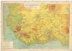
Carte physique de l'Afrique occidentale française
1 : 3000000 Afrika západní Meunier, Alexandre
Partie occidentale de l'Afrique
1 : 9600000 Afrika západní Bonne, Rigobert André
Justus Perthes' Africa (10 sheets), section Western Sudan