Maps of Germany
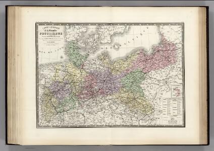
Prussienne.
1 : 2400000 Levasseur, E.
Monarchie Prussienne.
1 : 2400000 Brue, Adrien Hubert, 1786-1832
North German Confederation and Prussia.
1 : 2217600 Fullarton, A. & Co.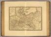
Monarchie Prussienne.
1 : 2400000 Picquet, C.
Preussen
Prussia with Part of Poland.
1 : 2900000 Teesdale, Henry

Prussian States.
1 : 3900000 Greenleaf, Jeremiah
Prussian States.
1 : 3900000 Greenleaf, Jeremiah
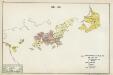
IV. 1640 - 1688
Brandenburg Expansion
[Historisch-geographischer Atlas zu den allgemeinen Geschichtswerken von C. v. Rotteck, Pölitz u. Becker] : Preussen eine Uebersicht der Bildung und der Hauptbegebenheiten dieses Staates
von Julius Loewenberg Lithographie von B. Herder in Freiburg im Breisgau [Freiburg im Breisgau] : [Herder]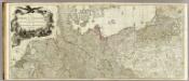
Map of the Empire of Germany (Northern section)
1 : 1250000 Delarochette, Louis Stanislas d'Arcy
Prussia.
1 : 4360000 Higgins, W.M.
Monarchie Prussienne.
Andriveau-Goujon, J.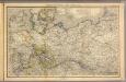
Nord- u. Mittel-Deutschland, nebst Daenemark.
1 : 1900000 Stein, Christ. Gottfr. Dan.
Karte von Preussen
1 : 2300000 Prusko Tranquillo Mollo
Karte von Preussen
1 : 2300000 Prusko Mollo, Tranquillo Tranquillo Mollo
Politische Übersicht von Nord-Deutschland und Preussen
E. von Sydow's Schul-Atlas in sechs und dreissig Karten Sydow, Emil von bei Justus Perthes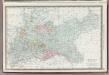
Germany Northern Portion.
1 : 2500000 Rand McNally and Company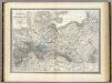
Preussische Staate.
1 : 1800000 Weiland, C. F. (Carl Ferdinand), d. 1847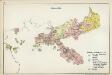
VI. 1740 - 1786
Preußen
Die Preussische Monarchie
Preußen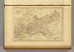
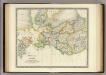
Prusse.
1 : 4100000 Malte-Brun, Conrad, 1775-1826
X. Seit 1861
Preußen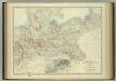
Empire of Germany (northern portion).
1 : 2032000 Johnston, W. & A.K.
Karte vom Preussischen Staate mit den Bundesstaaten in Nord-Deutschland
1 : 2400000 Neuchâtel (Švýcarsko) Bimbé, Wilhelm K.A. Kümmel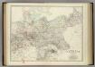
Empire of Germany (northern portion).
1 : 2032000 Johnston, Alexander Keith
Carte Generale du Royaume de Prusse.
1 : 3000000 Vivien de St Martin, L.