Maps of Germany

L'Allemagne Occidentale.
1 : 1800000 Levasseur, E.
Länder der Bundesrepublik 1993
Deutschland Kunz, Andreas ; Moeschl, Joachim Robert
Länder der Bundesrepublik 1952
Deutschland, Bundesrepublik Kunz, Andreas ; Moeschl, Joachim Robert
Besatzungszonen und Länder 1947
Deutschland Besatzungszone Kunz, Andreas ; Moeschl, Joachim Robert
Länder der Bundesrepublik 1957
Deutschland, Bundesrepublik Kunz, Andreas ; Moeschl, Joachim Robert
Länder der Bundesrepublik 1989
Deutschland, Bundesrepublik Kunz, Andreas ; Moeschl, Joachim Robert
Länder 1947
Deutschland Kunz, Andreas ; Moeschl, Joachim Robert
Länder der Bundesrepublik 1949
Deutschland, Bundesrepublik Kunz, Andreas ; Moeschl, Joachim Robert
Länder der Bundesrepublik 31.12.1990
Deutschland Kunz, Andreas ; Moeschl, Joachim Robert
Länder der Bundesrepublik 2003
Deutschland Kunz, Andreas ; Moeschl, Joachim Robert
Länder der Bundesrepublik 1955
Deutschland, Bundesrepublik Kunz, Andreas ; Moeschl, Joachim Robert
Allemagne.
1 : 1850000 Brue, Adrien Hubert, 1786-1832
Die Beiden Deutschen Staaten

Geschichtl. Entwicklung des Königr. Preussen bis zum Frieden von Tilsit (1807)
Deutschland, Preußen, Tilsit / Friede
Germany, W. sheet.
1 : 1400000 Rand McNally and Company
Germany.
1 : 1788000 Hammond, C.S.
Schiffahrtsstraßen in Deutschland Stand 1989
Deutschland Wasserstraße, Binnenschifffahrt Kunz, Andreas ; Moeschl, Joachim Robert
Germany.
1 : 1870000 Hughes, William
German Empire W.
1 : 1330560 Stanford, Edward
Post-Reise-Karte von Deutschland mit spezieller Angabe der Eisenbahn- und Dampschiffahrt- Verbindungen
1 : 1820000 Německo Hagendorn, von Piloty & Loehle
Post-Reise-Karte von Deutschland mit spezielle Angabe der Eisenbahn- und Dampschiffahrt- Verbindungen
Německo Hagedorn, von Fhr. von Hagedorn
Germany.
1 : 3300000 Tanner, Henry S.
Germany.
1 : 3294720 Tanner, Henry S.
Allemagne occidentale.
1 : 1850000 Picquet, C.
Germany.
1 : 3168000 Tallis, J. & F.
German States.
1 : 2050000 Teesdale, Henry
Germany.
1 : 3250000 Mitchell, Samuel Augustus
Germany-Czechoslovakia-Poland
Germany-Czechoslovakia-Poland [Aerodromes, Landing grounds, Seaplane bases], ADI (Maps) AM 8058A. [S.l.] : Air Ministry, United Kingdom
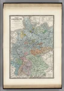
Etats Secondaires de L'Allemagne.
Andriveau-Goujon, J.
Bojiště francouzsko-německé
Evropa střední Bedřich Sandtner
Bojiště francouzsko-německé
Evropa střední Bedřich Sandtner