Maps of Germany
Allemagne en 1789.
1 : 3580000 Levasseur, E.
Neueste Post-Karte von Deutschland und demgrösten Theil der umliegenden Staaten oder Mitter-Europa
1 : 2340000 Evropa střední Fried, Franz List, Joseph bey Artaria et Compagnie
Neueste Post-Karte von Deutschland und dem grösten Theil der umliegenden Staaten oder Mittel-Europa
1 : 2350000 Evropa střední Fried, Franz List, C. Artaria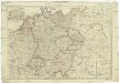
Deutschland nach seiner neuesten Grenz-Berichtigung
1 : 2350000 Evropa střední Mollo, Tranquillo T. Mollo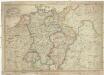
Deutschland nach seiner neuesten Grenz-berichtigung
1 : 2350000 Evropa střední Mollo, Tranquillo T. Mollo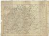
Deutschland nach seiner neuesten Grenz-Berichtigung
1 : 2370000 Evropa střední Mollo, Tranquillo bey T. Mollo
Tabula Moderna Germanie [Karte], in: Claudii Ptolemei viri Alexandrini mathematice discipline philosophi doctissimi geographie opus [...], S. 245.
1 Karte aus Atlas Waldseemüller, Martin [und Ptolemaeus, Claudius] Übelin, Georg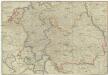
Postkarte durch ganz Teutschland, Italien, Frankreich, Niederland, Preussen, Polen und Ungarn
1 : 2100000 Evropa střední Mollo, Tranquillo T. Mollo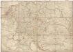
Postkarte durch ganz Teutschland, Italien, Frankreich, Niederland, Preussen, Polen und Ungarn
1 : 2100000 Evropa střední Mollo, Tranquillo T. Mollo & Comp.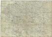
Postkarte durch ganz Teutschland, Italien, Frankreich, Niederland, Preussen, Polen und Ungarn
1 : 2100000 Evropa jihovýchodní Mollo, Tranquillo chez T. Mollo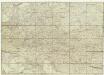
Neue und vollkomene Postkarte durch ganz Teutschland
Francie Artaria
Mitteleuropa
1 : 3500000 Evropa střední Köcher
Střední Evropa v zájmu světového míru
1 : 5000000 Evropa střední Kuffner, Hanuš
Deutschland 1555
Deutschland Kunz, Andreas ; Moeschl, Joachim Robert
L'Allemagne 843 a 911.
1 : 6300000 Houze, Antoine Philippe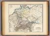
Germania, Raetia, Noricum.
1 : 3800000 Menke, Th.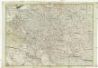
Neue und vollkomene Postkarte durch ganz Teutschland
1 : 2100000 Evropa jihovýchodní bey Artaria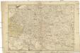
Neue und vollkomene Postkarte durch ganz Teutschland
1 : 2100000 Evropa jihovýchodní Artaria
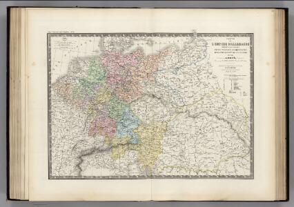
Deutsches Reich. Niederlande, Belgien & Schweiz
Adolf Stieler's Handatlas über alle Theile der Erde und über das Weltgebäude Stieler, Adolf Justus Perthes
Sbírka map a diagramů použitých na mírových konferencích v Paříži v letech 1919 - 1920

Deutschland 1648
Deutschland Kunz, Andreas ; Moeschl, Joachim Robert
Deutschland 1803 nach dem Reichsdeputationshauptschluss
Deutschland Reichsdeputationshauptschluss Kunz, Andreas ; Moeschl, Joachim Robert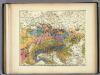
Geologische Karte von Deutschland und den anlieg.
1 : 4600000 Berghaus, Heinrich
Germany.
1 : 6000000 Finley, Anthony
Post und Eisenbahn Reisekarte von Central Europa

Deutschland um 1378
Deutschland Kunz, Andreas ; Moeschl, Joachim Robert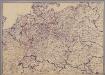
[Mitteleuropa]
1 : 2500000 [S.l. : s.n.]
l'Allemagne par Cercles in 1789.
1 : 6300000 Malte-Brun, Conrad, 1775-1826
La Germanie 741 a 843.
1 : 6300000 Houze, Antoine Philippe