Maps of Great Lakes

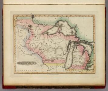
Michigan Ter.
1 : 4435200 Lucas, Fielding Jr.
North Western and MichiganTerritories.
1 : 4400000 Lucas, Fielding Jr.
Northern Steamship Co. (map)
1 : 4752000 Northern Steamship Company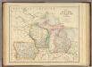
States of Michigan, Wisconsin and Iowa.
1 : 3453120 Rogers, Henry Darwin
134-35. Mich., Wis., Minn., Ia., Mo., Ill., Ind., Ky.
1 : 3000000 Touring club italiano
Michigan, Minnesota, and Wisconsin.
1 : 3000000 Lloyd, H.H.
Michigan, Minnesota, and Wisconsin.
1 : 3000000 Walling, H. F.
Soil Map of the United States, Section 2. Atlas of American Agriculture.
1 : 2500000 Marbut, Curtis F.
Sheet 1: United States of Nth. America.
1 : 1584000 Tardieu, P.F.
Upper Territories of the United States.
1 : 2060000 Carey, Mathew
Upper Territories of the United States.
1 : 3700000 Carey, Mathew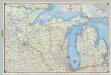
Shell Sectional Map No. 6 - North Central States.
1 : 1710720 Shell Oil Company
Michigan, Wisconsin, Iowa, & Minnesota.
1 : 3200000 Black, Adam & Charles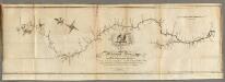
Map of the Mississippi River from its Source to the Mouth of the Missouri.
1 : 1584000 Pike, Zebulon Montgomery
Plan of Captain Carvers Travels in the interior Parts of North America.
1 : 2851200 Carver, Jonathan
United States 3.
1 : 1750000 Arrowsmith, Aaron
Climatology of Michigan ... isothermals January, July, summer, winter.
1 : 5000000 Winchell, Alexander, 1824-1891
Climatology of Michigan ... isothermals spring, autumn, year average.
1 : 5000000 Winchell, Alexander, 1824-1891
[Horní tok Mississippi]
Mississippi, řeka-oblast
Ontario.
Rand McNally and Company
County map of Michigan, and Wisconsin.
from Mitchell's new general atlas, containing maps of the various countries of the world, plans of cities, etc., embraced in fifty-three quarto maps., forming a series of eighty four maps and plans, together with valuable statistical tables.
Upper Territories of the the United States.
1 : 5900000 Lucas, Fielding Jr.
Michigan and Wisconsin.
1 : 3651000 Fisher, Richard Swainson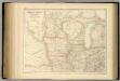
United States ... North Central Section.
1 : 2851200 Fullarton, A. & Co.
Canada, Louisiane et Terres Angloises. (Northwest section)
1 : 2900000 Anville, Jean Baptiste Bourguignon d, 1697-1782
Minnisota und Wisconsin.
1 : 5200000 Lange, Henry, 1821-1893.
N. W. Territory.
1 : 8236800 Carey, Mathew
Iowa, Wisconsin.
1 : 3380000 Nicollet, J. N. (Joseph Nicolas), 1786-1843
PARTIE ORIENTALE DE LA NOUVELLE FRANCE OU DU CANADA
1 : 3710000 Kanada Bellin, Jacques-Nicolas par les Heritiers de Homan
PARTIE ORIENTALE DE LA NOUVELLE FRANCE OU DU CANADA
1 : 3710000 Kanada Bellin, Jacques-Nicolas par les Heritiers de Homan