Maps of Switzerland

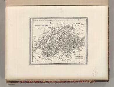
Switzerland.
1 : 1270000 Tanner, Henry S.
Nova Helvetiae tabula geographica illustrissimis et potentissimis cantonibus et rebuspublicis reformatae religionis Tigurinae, Bernensi, Glaronensi, Basiliensi, Scaphusianae, Abbatis Cellanae
1 : 230000 1 Karte auf 4 Bl. dominis suis clementissimis humilime dicata a Ioh. Iacobo Scheuchzero Tigurino ; Ioh. Melch. Füsslin ornamenta pinx. ; Ioh. Henr. Huber et Eman. Schalch sculps. [Hofmeister], [Zürich]
[53][53] Exactissima Helvetiae, Rhetioae, Valesia ..., uit: Atlas sive Descriptio terrarum orbis
Annotatie: Gedigitaliseerde versie. Amsterdam. Heiloo : Picturae (vervaardiger), 2015. tiff-bestand. Gedigitaliseerd: 07-01-2015; Origineel: Universiteitsbibliotheek Vrije Universiteit (XL.05127.-) ; Netherlands; Titelpagina ontbreekt Wit, Frederik de Amsterdam : Frederick de Wit
<<La>> Suisse divisée en ses treze canton, ses alliéz et ses sujets
1 : 1250000 1 Karte [Homännische Erben?], [Nürnberg?]
Nova totius Helvetiae cum suis subditis ac sociis tab. geogr
1 : 790000 1 Karte studio manu ac sumtibus Matth. Seut. Seutter, [Augsburg]
<<La>> Suisse divisée en ses treze canton, ses alliéz et ses sujets
1 : 1250000 1 Karte [Homännische Erben?], [Nürnberg?]
Charte der Schweiz in seine Cantone eingetheilt
1 : 520000 1 Karte [Johannes Walch] Joh. Walch, Augsburg
<<L'>>Elvezia divisa ne suoi tredici cantoni e suoi alleati
1 : 900000 1 Karte G. Zuliani inc. ; G. Pitteri scri. presso Antonio Zatta, Venezia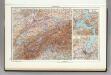
78. Switzerland. Geneva. The World Atlas.
1 : 1250000 USSR (Union of Soviet Socialist Republics).
Helvetien
1 : 525000 1 Karte nach den zuverlässigsten astronomischen Bestimmungen, aus den Charten von Weisse, Bacler d'Albe, Mallet, Feer und andern einzelnen Blättern zusammengesetzt von Conrad Mannert Adam Gottlieb Schneider u. Weigels, Nürnberg
Carte générale des trèze cantons de Suisse, Vallay, ligues Grise, Maison-Dieu & Valteline
1 : 725000 1 Karte [par Nicolas Berey] 1654 chez N. Langlois, rue S. Jacques à la Victoire, Paris
Tourist map of Switzerland
1 : 600000 Evropa Swiss national tourist office
Automobil-Karte der Schweiz
1 : 400000 Švýcarsko Kümmerly & Frey
Reise- und Verkehrskarte der Schweiz
1 : 400000 Švýcarsko A. Meissner
Kleine officielle Eisenbahnkarte der Schweiz
1 : 500000 1 Karte gest. von R. Leuzinger ; Schweizer. Post- und Eisenbahndepartement = Petite carte officielle des chemins de fer de la Suisse Kümmerly, Bern
Switzerland
1 : 700000 1 Karte by Sidney Hall Longman, London
Nova Helvetiae, foederatarumque cum ea, nec non subditarum regionum tabula, ad usum serenissimi Burgundiae ducis, secundum commentarios domini Merveilleux
1 Karte composita per Gulielmum de l'Isle apud Joh. Covens & Corn. Mortier, Amstelodami
<<Die>> Schweiz
1 : 1200000 1 Karte F.A. Brockhaus, Leipzig
Exactissima Helvetiae, Valesiae caeterorumq. confoederatorum ut et finitimorum populorum regionum tabula
1 Karte ex conatibus Nicolai Visscher ; A. Hogeboom sculp. Visscher, [Amsterdam]
Nova et accuratissima Helvetiae foederatarumque cum ea, nec non subditarum, regionum tabula
1 Karte primum composita per de l'Isle, nunc vero aucta & emendata = Les cantons suisses, leurs alliés & pays sujets / composée par Guillaume de l'Isle, corrigée & augmentée, le plus nouvelles chez Elwe & Langeveld, Amsterdam
Schweizerische Eisenbahnen; offizielle Übersichtskarte
Mit Legenden in deutscher und französischer Sprache. Leuzinger, Rudolf (1826-1896), Kartograf und Lithograf, von Netstal GL und Mollis GL Herausgeber: Schweizerisches Post- und Eisenbahndepartement
Nova Helvetiae tabula
1 : 780000 1 Karte ex officina Iudoci Hondij F., Amstelodami
<<Die>> Schweiz
1 : 870000 1 Karte entworfen und gezeichnet vom Major C. Radefeld ; gest.: [Th.] Macht u. [W.] Feuerstein Bibliographisches Institut, Hildburghausen
Nouvelle carte de la Suisse divisées en ses treize cantons, ses alliéz et ses sujets
1 : 240000 1 Karte auf 4 Bl. par Jean Jacob Scheuchzer chez Jean Cóvens et Corneille Mortier, Amsterdam
Die Schweiz mit den projektierten Eisenbahnen; Übersichtskarte
Mit Legende. Ohne Datumsangabe. Joh. Wurster und Comp., in Winterthur
Übersichtskarte des schweizerischen Pegel- und Witterungsstationennetzes
1 : 600000 1 Karte Wurster, Winterthur
<<La>> Suisse divisée en ses treze cantons, ses alliéz & ses sujets
1 Karte par Sanson chez I Covens et C. Mortier, Amsterdam
<<Die>> Schweiz
1 : 930000 1 Karte entw. u. gez. v. A. St. 1820 ; Situation gest. v. L. Thiel ; die Schrift von I.B. [Perthes], [Gotha]