Maps of Germany
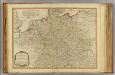
Germany.
1 : 2400000 Playfair, Principal
Mappa geographica exhibens postas omnes tam vehiculares quam veredarias totius Germaniae cum earum accurata distantia
1 : 2500000 diligentissime propriis sumptibus excudit Tobias Conrad Lotter Aug. Vindelicor : Tob. Conr. Lotter
Historia Imperii Romano-Germanici, nec non finitimarum regionum
1 : 2700000 Evropa střední Seutter, Matthäus Matthaeo Seutter
Historia Imperii Romano-Germanici, nec non finitimarum regionum
1 : 2700000 Evropa střední Seutter, Matthäus Matthaeo Seutter
Imperium Romano-Germanicum in suos circulos electorat. et status
1 : 2700000 Evropa střední Seutter, Matthäus apud Matth. Seutter
Imperium Romano-Germanicum in suos circulos electorat. et status
1 : 2700000 Evropa střední Seutter, Matthäus Matth. Seutter
Imperium Romano-Germanicum in suos circulos electorat. et status
1 : 2700000 Evropa střední Seutter, Matthäus Matth. Seutter
Postarum seu cursorum publicorum diverticula et mansiones per Germaniam et confin. provincias
Evropa střední Seutter, Matthäus opera et manu M. Seutteri
Postarum seu cursorum publicorum diverticula et mansiones per Germaniam et confin. provincias
Evropa střední Seutter, Matthäus opera et manu M. Seutteri
Postarum seu cursorum publicorum diverticula et mansiones per Germaniam et confin. provincias
Belgie Seutter, Matthäus opera et manu M. Seutteri
Bez titulu: soubor map pag. 125

Neueste Eisenbahn-Karte von Deutschland und den angrenzenden Ländern
Evropa střední Walseck, Georg Georg Walseck
Imperium Romano-Germanicum
1 : 2600000 Mollova mapová sbírka Seutter, Matthäus Seutter, Matthäus
Altgermanien, Sud-Donau-Lander, Mitte des Vten jahrhundert's.
1 : 3800000 Spruner von Merz, Karl
Mappa Geographica exhibens Postas

Reisekarte von Deutschland und den angrenzenden Ländern
Evropa střední Mahlmann, H. Morin, F. H. F.H. Morin
Reise - Karte von Deutschland und den Nachbarstaaten

Karte von Deutschland und einem Theile der angrenzenden Länder mit Angabe sämmtlicher Eisenbahnen
1 : 2300000 Evropa střední
General Karte von Deutschland
Germania Antiqua.
1 : 4900000 Delamarche, Felix
Landtaflen
1 Atlas [von Johannes Stumpf] Christoffel Froschower, Zürych
Tabula Novissima Totius Germaniae
1 : 1300000 Mollova mapová sbírka Eisenschmidt, Johann Caspar Homann, Johann Baptista
Tabula Germaniae
1 : 2780000 Evropa střední Visscher, Claes Jansz. Broeck, Abraham van den Claes Ianßen Visscher excudebat
Hydrographica Germaniae...
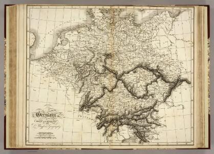
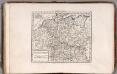
Germany.
1 : 2400000 Robert Laurie & James Whittle
Deutschland unter den Hohenstaufen, und bis 1275.
1 : 3800000 Spruner von Merz, Karl
Deutschland, Ubersicht Des Deutschen Reichs.
1 : 3700000 Berghaus, Hermann
Deutschland Und Benachbarte Lander. Zur Ubersicht Der Eisenbahnen Und Dampfschiffahrten.
1 : 3700000 Vogel, C.
Charte von Deutschland und den angränzenden Theilen der benachbarten Länder
1 : 1310000 Evropa střední Güssefeld, Franz L. Homanns Erben