Maps of Allegheny Plat.

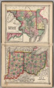
Maryland and Delaware. Ohio and Indiana.
1 : 2100000 Schonberg & Co.
Railroad & Express Map of the Middle States
1 : 1267200 Railroad & Express Map of the Middle States. R. Blanchard.
179. Center manufactures, population 1790-1900.
1 : 3900000 Gannett, Henry, 1846-1914
16. Center of population 1790-1900.
1 : 3900000 Gannett, Henry, 1846-1914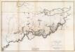
General Map of the Course of the Ohio.
1 : 563200 Tardieu, P.F.
The State of Ohio, with part of Upper Canada, &c.
from Carey's general atlas, improved and enlarged : being a collection of maps of the world and quarters, their principal empires, kingdoms, &c.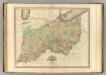
Ohio and Indiana.
1 : 1110000 Tanner, Henry S.
The state of Virginia : from the best authorities / by Samuel Lewis, 1794 ; Smither, sculpt.
from Notes on the State of Virginia. By Thomas Jefferson.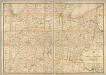
Post route map of the states of Ohio and Indiana with Cinncinnati and environs.
1 : 506880 United States. Post Office Dept.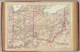
Ohio, Indiana.
1 : 1267200 Asher & Adams
A correct map of Virginia.
from Carey's general atlas, improved and enlarged : being a collection of maps of the world and quarters, their principal empires, kingdoms, &c.
The tourist's pocket map of Pennsylvania : exhibiting its internal improvements, roads, distances &c. / by J.H. Young ; D. Haines, sc.
from Whole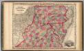
Pennsylvania And Virginia.
1 : 1520640 Johnson, A.J.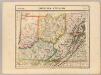
Parties des Etats-Unis. Amer. Sep. 50.
1 : 1641836 Vandermaelen, Philippe, 1795-1869
Map Pittsburgh & Western Railway Co.
1 : 5844000 Pittsburgh & Western Railway Company
Eastern U.S.
1 : 2750000 Cornell, S. S. (Sarah S.)
Map of Virginia and Maryland, constructed from the latest authorities / J.H. Young sc.
from Parts
Virginia, Maryland, and Delaware / by H.S. Tanner.
from Charts and maps
Virginia and Maryland / By H. Moll, geographer.
from Parts
The tourist's pocket map of the state of Virginia : exhibiting its internal improvements, roads, distances, &c. / by J.H. Young ; engraved by E. Yeager & F. Dankworth.
from Virginia
Ohio, Indiana & Illinois.
1 : 2400000 Black, Adam & Charles
Virginia.
from Supplement to the New York observer.
County map of Pennsylvania, New Jersey, Maryland and Delaware ; City of Philadelphia [inset]; City of Baltimore [inset].
from Mitchell's new general atlas, containing maps of the various countries of the world, plans of cities, etc., embraced in fifty-three quarto maps., forming a series of eighty four maps and plans, together with valuable statistical tables.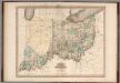
Ohio and Indiana.
1 : 1100000 Tanner, Henry S.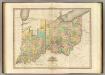
Ohio And Indiana.
1 : 1140480 Tanner, Henry S.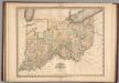
Ohio and Indiana.
1 : 1100000 Tanner, Henry S.
Ohio and Indiana.
1 : 1100000 Tanner, Henry S.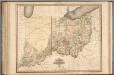
Ohio and Indiana.
1 : 1100000 Tanner, Henry S.
Ohio & Indiana.
1 : 1300000 Asher & Adams