Maps of Town of Greenburgh
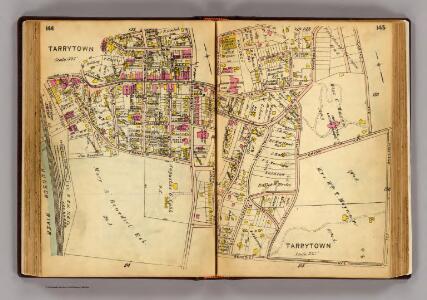
144-145 Tarrytown.
1 : 4500 G.W. Bromley & Co.
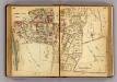
Plan of Beekmantown, Tarrytown and Irving, Westchester County, New York.
1 : 3960 Beers, Frederick W.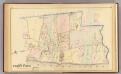
Tarrytown.
1 : 5900 Bromley, George Washington; Bromley, Walter Scott; G.W. Bromley & Co.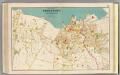
Tarrytown, N. Tarrytown.
1 : 3960 Bien, Joseph Rudolf
Plates 42 & 43: Tarrytown Heights Land Company, Plan of the Land, belonging to the Company.
from County atlas of Westchester, New York. Published by J.B. Beers & Co., assisted by S.W. Wilson and others.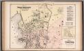
North Tarrytown and Tarrytown, Westchester County, New York. (inset) Glenville.
1 : 3960 Beers, J.B.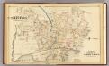
N. Tarrytown, Tarrytown.
1 : 3000 Bromley, George Washington; Bromley, Walter Scott; G.W. Bromley & Co.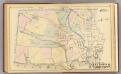
Tarrytown, N. Tarrytown.
1 : 6000 Bromley, George Washington; Bromley, Walter Scott; G.W. Bromley & Co.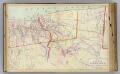
E4 Tarrytown, N. Tarrytown.
1 : 9600 Watson & Co. (New York, N.Y.)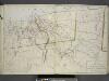
Plan of Tarrytown, North Tarrytown, and Surroundings.
from Atlas of the Hudson River Valley from New York city to Troy, including a section of about 8 miles in width. Published by Watson & co. Compiled from official records and careful surveys, under the supervision of F. W. Beers.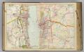
7 Rockland, Westchester counties.
1 : 14400 Watson & Co. (New York, N.Y.)
5 Greenburg.
1 : 18000 Hyde & Company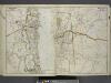
Portion of Rockland County. ; Portion of Westchester County.
from Atlas of the Hudson River Valley from New York city to Troy, including a section of about 8 miles in width. Published by Watson & co. Compiled from official records and careful surveys, under the supervision of F. W. Beers.
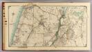
Greenburgh, Westchester County, New York.
1 : 42240 Beers, Frederick W.
Greenburg town.
1 : 21120 Bien, Joseph Rudolf
White Plains
1 : 24000
White Plains
1 : 24000
White Plains
1 : 24000
White Plains
1 : 24000
White Plains
1 : 24000
White Plains
1 : 24000
White Plains
1 : 31680
White Plains
1 : 31680
White Plains
1 : 24000
6 Ossining, Mt. Pleasant.
1 : 18000 Hyde & Company
Mt. Pleasant, Town.
1 : 38016 Beers, F. W. (Frederick W.)
Town of Greenburgh, Westchester County, New York.
1 : 42240 Beers, Frederick W.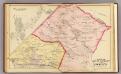
Mt. Pleasant, Ossining.
1 : 24000 Bromley, George Washington; Bromley, Walter Scott; G.W. Bromley & Co.
North part of Town of Mount Pleasant - Pleasantville.
from County atlas of Westchester, New York. Published by J.B. Beers & Co., assisted by S.W. Wilson and others.