Maps of Teton County

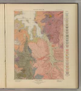
Lake Sheet.
1 : 125000 Hague, Arnold
Lake
1 : 125000
Lake
1 : 125000
Lake
1 : 125000
Lake
1 : 125000
Lake
1 : 125000
Lake
1 : 125000
Lake
1 : 125000
Lake
1 : 125000
Frank Island
1 : 62500
Frank Island
1 : 62500
Frank Island
1 : 62500
The Shores of Yellowstone Lake.
1 : 84500 Hague, Arnold
Mount Hancock
1 : 62500
Mount Hancock
1 : 62500
Mount Hancock
1 : 62500
Mount Hancock
1 : 24000
Crooked Creek
1 : 24000
Badger Creek
1 : 24000
Mount Hancock
1 : 24000
Crooked Creek
1 : 24000
Badger Creek
1 : 24000
Trail Lake
1 : 24000
Heart Lake
1 : 24000
Alder Lake
1 : 24000
Sylvan Lake
1 : 24000
Sylvan Lake
1 : 24000
Sylvan Lake
1 : 24000
Dot Island
1 : 24000