Maps of Coastal Plain

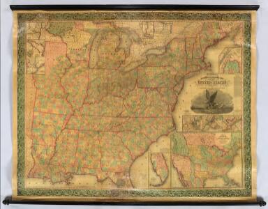
Mitchell's Reference & Distance Map Of The United States.
1 : 1584000 Young, James H.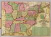
Mitchell's National Map of the American Republic
1 : 3400000 Mitchell, Samuel Augustus
United States.
1 : 6000000 Colton, J. H.
Mitchell's Reference & Distance Map Of The United States.
1 : 1584000 Young, James H.
Reference & Distance Map Of The United States.
1 : 1584000 Young, James H.
Mitchell's Reference & Distance Map Of The United States.
1 : 1584000 Young, James H.
Mitchell's map of the United States.
1 : 14752000 Mitchell, Samuel Augustus
[Kaart], uit: Appleton's spoorwegkaart van de Vereenigde Staten en Canada / door G.F. Thomas ; engraved by Rae Smith
1 : 3550000 titelvariant: Spoorwegkaart van de Vereenigde Staten en Canada; Annotatie: Oorspr. uitg. 1871 uitg. door D. Appleton G.F. Thomas fl. 1872; Smith, Rae Amsterdam : J.H. Laarman
Mitchell's Reference & Distance Map Of The United States.
1 : 1584000 Young, James H.
United States.
1 : 1500000 Smith, J. Calvin
Chapin's Ornamental Map Of The United States.
1 : 2150000 Chapin, William
New Map of the United States.
1 : 1584000 Young, James H.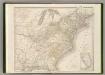
Etats-Unis d'Amerique.
1 : 4200000 Poussin, Guillaume Tell, 1794-1876
Karte der katholischen Diocesen und deren Missionen in Nordamerika nach den neuesten geographischen Angaben
1 : 22430000 Spojené státy americké-oblast východní Salzbacher, Joseph Engel, H. Joseph Salzbacher
United States.
1 : 1900800 Varle, Charles P.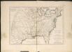
Carte de la Louisiane cours du Mississipi et pais voisins
1 : 6000000
United States Of North America.
1 : 1550000 Arrowsmith, Aaron
Map of the United States of America.
1 : 4942080 Maclure, William
Mitchell's Reference & Distance Map of the United States.
1 : 1584000 Young, James H.
An accurate map of the United States of America: according to the Treaty of Peace of 1783.
from Whole Published as the Act directs by H.D. (Henry Delahoy) Symonds: London; Russell, John,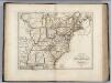
United States of America.
1 : 5630000 Carey, Mathew
Map of the United States of America.
1 : 6019200 Maclure, William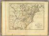
Map of the United States of America.
1 : 6000000 Carey, Mathew
Map of the United States of America.
1 : 6019200 Melish, John
United States.
1 : 10700000 Carey, Mathew
United States.
1 : 10700000 Carey, Mathew
General-Karte der Vereinigten Staaten von Nord Amerika, nebst den grösst. Theilen von Canada & Tejas : mit Bezeichnung sämmtlicher Cantons, deren Haupt-u. Handelstädte, Eisenbahnen, Kunst- & Hauptstrassen, Canäle etc. etc.
1 : 3200000 nach den neuesten und besten New-Yorker Karten von J. Calvin Smith und H.S. Tanner, sowie nach Berghaus, Länder-& Völkerkunde entw. u. gez. von Albrecht Platt in Stein gest. u. gedr. im geogr. Institut von Albr. Platt ; in Stein gestochen v. Bomsdorf Magdeburg : Kaegelmann
United States.
1 : 1500000 Smith, J. Calvin
Alden's Pictorial Map Of The United States Of North America.
1 : 2851200 Alden, Albert