Maps of Cumberland Plat.

Sheet 3: United States of Nth. America.
1 : 1584000 Tardieu, P.F.
United States.
1 : 3380000 Sharpe, J.
Map of Louisiana, Mississippi, and Arkansas.
from New general atlas.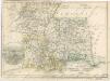
Die Staaten von Arkansas, Mississippi, Louisiana und Alabama
War chart of the Southern States showing the towns, rivers, rail-roads and common roads
B.B. Russell & Co.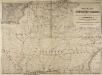
Railway Map of the Southern States, showing the Railway Lines, their Stations and intermediate distances between Louisville and the Gulf of Mexico and Southern Atlantic Coast, etc. Scale of miles, 20 to one inch.
Railway Map of the Southern States, showing the Railway Lines, their Stations and intermediate distances between Louisville and the Gulf of Mexico and Southern Atlantic Coast, etc.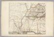
Sheet 3: United States of Nth. America.
1 : 1584000 Tardieu, P.F.
Map of the south western part of the United States
1 : 5300000 Virtue, Yorston & Co.
A New map of the province of Maryland in North America
1 : 1170000 Hinton, John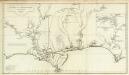
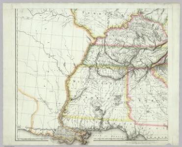
Carte de la Louisiane.
1 : 830000 Anville, Jean Baptiste Bourguignon d, 1697-1782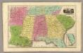
Southern States. (with) South Part of Florida.
1 : 3450000 Smiley, Thomas T.
The Field of Battle.
The Field of Battle and Prominent US Generals. The Field of Battle and Prominent Union Generals is one of the most picturesque maps in the collection, detailing the main theatres of conflict in the Confederacy, with each state broken up by counties, and surrounded by virtually all of the main Union Army generals that would have been well known to viewers in 1864 when this map was published in New York by Ensign & Bridgman. The generals are mostly all arranged close to the areas where they were conducting operations at the time of the map’s production, for example Generals Grant and Sherman are close to Georgia and South Carolina. Union Navy generals are also pictured, such as General David Farragut who can be seen close to the Georgia coastline. Ensign & Bridgman
Mississippi Territory.
from Carey's general atlas, improved and enlarged : being a collection of maps of the world and quarters, their principal empires, kingdoms, &c.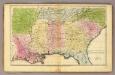
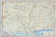
Southern States.
1 : 3600000 Huntington, Francis Junius, 1802-1878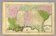
Southern States.
1 : 3500000 Olney, J. (Jesse), 1798-1872
206-207. United States of America, South Central. The World Atlas.
1 : 2500000 USSR (Union of Soviet Socialist Republics).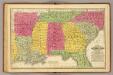
Southern States.
1 : 3700000 Mitchell, Samuel Augustus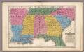
Map of the Southern States.
1 : 3700000 Mitchell, Samuel Augustus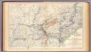
Military map, W.T. Sherman.
1 : 2200000 United States. War Department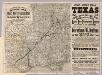
Intl. & Gt. N. Railroad.
1 : 3261700 Rand McNally and Company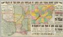
Texas Short Line.
1 : 3400000 St. Louis, Iron Mountain, and Southern Railway Company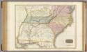
United States of America, southern part.
1 : 2200000 Pinkerton, John, 1758-1826
Military map showing the marches of the United States Forces 1863-1865.
1 : 1267200 United States. Army. Military Division of the Mississippi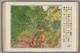
Soil Map of the United States, Section 7. Atlas of American Agriculture.
1 : 2500000 Marbut, Curtis F.
Alabama, Arkansas, Louisiana, and Mississippi.
1 : 3000000 Lloyd, H.H.
Alabama, Arkansas, Louisiana, and Mississippi.
1 : 3000000 Walling, H. F.
Mississippi, Louisiana, and Arkansas.
1 : 3623775 Fisher, Richard Swainson
Ala., Miss., La., Ark.
1 : 4700000 Grigg, John
Shell Highway Map of Arkansas-Louisiana, Mississippi.
1 : 1457280 Shell Oil Company