Maps of Lev HaSharon Regional Council
45 Cesaree.
1 : 100000 Jacotin, Pierre, 1765-1827
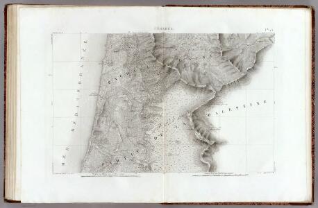
(Sheet 2). Western Palestine ... Reduced from the One-Inch Map. Scale 3/8 inch to one mile or 1:168,960.
1 : 168960 Kitchener, H.R. (Horatio Herbert)
Tantura, Palestine (1942)
Tantura, Palestine, MDR Misc 977. Great Britain. Army. Royal Engineers. Field Survey Company, 512th. [Cairo] : [Survey Directorate, Middle East]
Mukhalid & Arsuf
[Palestine]. Great Britain. Army. Royal Engineers. Field Survey Coy., 7th. [S.l.] : printed by Survey of Egypt
Tabula Moderna Terre Sancte [Karte], in: [Clavdii Ptholomei Cosmographi ...], S. 311.
1 Karte aus Atlas Nicolaus Germanus [und Ptolemaeus, Claudius]
Terra Sancta, sive Promissionis, olim Palestina / recens delineata, et in lucem edita per Nicolaum Visscher anno 1659
1 : 900000 Annotatie: Dit exemplaar bevat bij enige plaatsnamen aan de westkust aantekeningen in pen; Origineel is Blad 183 in atlas factice; Annotatie geografische gegevens: Schaalstokken op kaart: 6 Milliaria Germanica communia = 6 Gemeene Duytsche Mylen van 15 in een Graed (=4,8 cm), en: 8 Milliaria unius Horæ = 8 Uren gaens yder synde 24 Stadien dat is 3000 passé (=4,8 cm); Noordwest boven; Inzet: Castrorum populi Israelitici Nicolaes Jansz Visscher sr 1618-1679 [S.l. : C.J. Visscher excudit]
Iudaea, seu Terra Sancta quae hebraeorum sive Israelitarum in suas duodecim tribus divisa, secretis ab invicem regnis Iuda, et Israel expressis insuper sex ultimi temporis ejusdem terrae provinciis
1 : 600000 Izrael Sanson, Guillaume Schenk, Pieter Pierre Schenk
Iudaea, seu Terra Sancta quae Hebraeorum sive Israelitarum in suas duodecim tribus divisa, secretis ab invicem regnis Iuda, et Israel expressis insuper sex ultimi temporis ejusdem terrae provinciis
1 : 600000 Izrael Sanson, Guillaume Schenk, Pieter Pierre Schenk
Sitvs terrae Canaan, sive Terrae promissionis, hodie Palaestinae, Ss. Bibliorvm intelligentiam exacte aperiens
Kanaán Sanson, Nicolas Adrichem, Christiaan van Pierre Mortier
Palästina
Volksschul-Atlas über alle Teile der Erde Lange, Henry Druck und Verlag von Georg Westermann
Palaestina
1 : 170000 Palestina
Karte des Heiligen Landes
1 : 310000 Izrael Möller, Arnold Wilhelm A.W. Möller
TERRA SANCTA, SIVE PROMISSIONIS, olim PALESTINA
1 : 970000 Palestina Visscher, Nicolaus Visscher, Claes Jansz. C.I. Visscher excudit
Terra Sancta sive Promissionis, olim Palestina
1 : 970000 Palestina Visscher, Nicolaus per Nicolaum Visscher
Regio Canaan seu Terra Promissionis, postea Iudaea vel Palaestina nominata, hodie Terra Sancta vocata
1 : 3000000 Kanaán Seutter, Matthäus Rogg, Gottfried per Matth. Seutter
Afbeelding van 't land van Israël, naar deszelfs natuurlyke gesteltheid : waar in alle de zeën, rivieren en beeken, gelyk ook de bergen en dalen, de vlaktens, de woestynen, enz. dezes lands, die in de H.S. genoemt zyn, worden aangewezen
1 : 750000 door W.A. Bachiene J. van Jagen sculp. ; J.C. Philips fecit. te Gorinchem : by Nicolaas Goetzee
Kaart van het Heilige Land ten tijde van Josua en de Regteren
1 : 1100000 S.I. Mulder del. steend. v. C. W. Mieling [Leyden] : D. du Mortier & Fil. excud.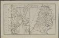
Schul-Atlas für die alte Erdbeschreibung : zur allgemeinen Schul-encyclopädie gehörig
J. H. Campe Zusammensetzung und Zeichnung von [...] Dufour, unter Leitung von Heusinger ; gestochen von Frentzel. Braunschweig : Schulbuchhandlung
Palestine.
1 : 1130000 Tanner, Henry S.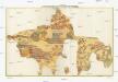
The Madaba Map
Jeruzalém Survey of Israel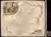
Iudaea sive Terra Sancta quae Israelitarum
1 : 690000 1 Karte : Kupferdruck ; 49 x 56 cm Danckerts, Theodorus [Danckerts]
Ancient Palestine.
1 : 990000 Hughes, William
Der Lebensweg Jesu
Izrael Harwerth, Willi Johannes Stauda
Palestine
1 : 200000 Palestina Survey of Egypt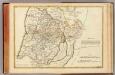
Terrae Sanctae 2.
1 : 394000 L'Isle, Joseph Nicolas de, 1688-1768
Iudaea seu Palaestina ob sacratißima redemtoris vestigia hodie dicta Terra Sancta
1 : 3100000 Kanaán Homann, Johann Baptist Sanson, Guillaume á Ioh. Baptista Homanno
Palestina čili Kanaan
Palestina Fried, Franz Luther, Th. nákladem Spolku Komenského
Palästina
1 : 250000 Palestina Preußische Landesaufnahme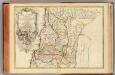
Terrae Sanctae 1.
1 : 394000 L'Isle, Joseph Nicolas de, 1688-1768
Carte géologique du Liban
1 : 200000 Libanon Zumoffen, G. Barrere, Henry l'Institut Cartographique