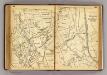
Maps of Town of Clarkstown

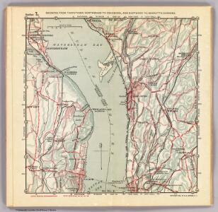
7. Tarrytown-Oscawana-Merritt's Corners.
1 : 80000 Servoss, R. D.
7. Tarrytown-Oscawana-Merritt's Corners.
1 : 80000 Servoss, R. D.
Croton Landing - Sparta.
from County atlas of Westchester, New York. Published by J.B. Beers & Co., assisted by S.W. Wilson and others.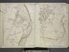
Portion of Rockland County. ; Portion of Westchester County.
from Atlas of the Hudson River Valley from New York city to Troy, including a section of about 8 miles in width. Published by Watson & co. Compiled from official records and careful surveys, under the supervision of F. W. Beers.
North part of Town of Mount Pleasant - Pleasantville.
from County atlas of Westchester, New York. Published by J.B. Beers & Co., assisted by S.W. Wilson and others.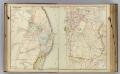
8 Rockland, Westchester counties.
1 : 14400 Watson & Co. (New York, N.Y.)
Haverstraw
1 : 24000
Haverstraw
1 : 24000
Haverstraw
1 : 24000
Haverstraw
1 : 24000
Haverstraw
1 : 31680
Haverstraw
1 : 31680
Haverstraw
1 : 24000
Ossining, Sparta.
1 : 25344 Beers, F. W. (Frederick W.)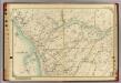
12 Atlas rural country district north of New York City.
1 : 18000 Hyde, E. Belcher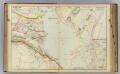
9 Rockland, Westchester counties.
1 : 14400 Watson & Co. (New York, N.Y.)
Ossining
1 : 24000
Ossining
1 : 24000
Ossining
1 : 24000
Ossining
1 : 24000
Ossining
1 : 24000
Ossining
1 : 24000
Ossining
1 : 31680
Ossining
1 : 25000
Ossining
1 : 31680
Ossining
1 : 31680
Ossining
1 : 24000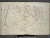
Plan of Sing Sing and part of Town of Ossining.
from Atlas of the Hudson River Valley from New York city to Troy, including a section of about 8 miles in width. Published by Watson & co. Compiled from official records and careful surveys, under the supervision of F. W. Beers.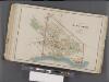
Westchester, Double Page Plate No. 24 [Map bounded by Underhill Rd., Hudson River] / prepared under the direction of Joseph R. Bien, from general surveys and official records.
From Atlas of Westchester County, New York