Maps of United States

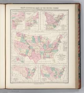
Historical Maps of the United States.
1 : 18000000 Gray, Ormando Willis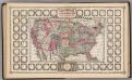
United States.
1 : 13411000 Schonberg & Co.
A Concise View of the Number, Resources, and Industry of the American People.
Mitchell, Samuel Augustus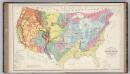
Geological Map of the United States.
1 : 7428000 Hitchcock, Charles H. (Charles Henry), 1836-1919
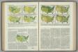
Humboldt's Distribution of Plants in Equinoctial America.
Hughes, William
United States of America (physical).
1 : 14495100 Fisher, Richard Swainson
72. Density, proportion, increase, foreign born, Negro.
1 : 55000000 Gannett, Henry, 1846-1914; United States. Census Office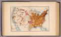
10. Population 1870.
1 : 14000000 Gannett, Henry, 1846-1914; United States. Census Office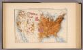
11. Population 1880.
1 : 14000000 Gannett, Henry, 1846-1914; United States. Census Office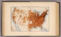
12. Population 1890.
1 : 14000000 Gannett, Henry, 1846-1914; United States. Census Office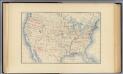
1. Accessions of territory.
1 : 14000000 Gannett, Henry, 1846-1914; United States. Census Office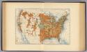
28. Increase 1890 to 1900.
1 : 14000000 Gannett, Henry, 1846-1914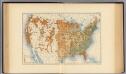
29. Predominating sex.
1 : 14000000 Gannett, Henry, 1846-1914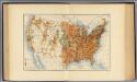
25. Density of increase of population, U.S., 1890-1900.
1 : 14000000 Gannett, Henry, 1846-1914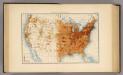
13. Population 1900.
1 : 14000000 Gannett, Henry, 1846-1914; United States. Census Office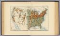
26. Population in cities >2000 inhabitants, 1900.
1 : 14000000 Gannett, Henry, 1846-1914
27. Density, urban, increase, whites, density of increase, foreign born.
1 : 55000000 Gannett, Henry, 1846-1914; United States. Census Office
Various Regions and Cities in Kansas.
Shell Oil Company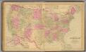
United States.
1 : 7603200 O.W. Gray & Son
United States of America. Pergamon World Atlas.
Polish Army Topography Service
Various Regions and Cities in Oklahoma.
Shell Oil Company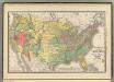
United States population increase 1880-1890.
1 : 10100000 Rand McNally and Company
United States population density 1890.
1 : 10100000 Rand McNally and Company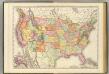
United States.
1 : 7300000 Rand McNally and Company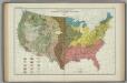
Great Soil Groups. Atlas of American Agriculture.
1 : 8000000 Marschner, Francis J.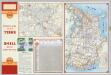
Various Regions and Cities in New Mexico.
Shell Oil Company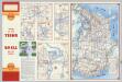
Various Regions and Cities in Iowa.
Shell Oil Company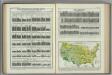
Annual Precipitation. Atlas of American Agriculture.
Kincer, Joseph Burton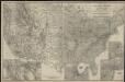
Aviation map of United States : featuring landing fields, improved, unimproved
1 : 4720000 Rand McNally and Company United States Touring Information Bureau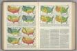
Temperature Thresholds by Date. Range of Temperatures. Atlas of American Agriculture.
Kincer, Joseph Burton