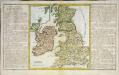
Maps of British Isles

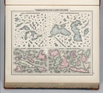
Comparative Size of Lakes and Islands.
Colton, G. Woolworth
Industrial map of the British Islands
1 : 1200000 Shetlandy (Skotsko) Hughes, W. George Philip & Son
Bretagne Romaine sous Honorius, 400 ans apres Jesus Christ.
1 : 4500000 Houze, Antoine Philippe
Great Britain and Ireland. .
1 : 3380000 Sharpe, J.
Isles Britanniques
1 : 3770000 Anglie Bonne, Rigobert André
Grande Bretagne, Irlande 1400 a 1603.
1 : 4500000 Houze, Antoine Philippe
Angleterre, Ecosse & Irlande en 900.
1 : 4500000 Houze, Antoine Philippe
Angleterre, Ecosse, Irlande et Man en 1100.
1 : 4500000 Houze, Antoine Philippe
Britannia et Hibernia.
1 : 3000000 Strabo
Philips' Railway Map of the British Isles
1 : 1087000 Edinburgh (Skotsko) George Philip & Son
British Isles. Pergamon World Atlas.
Polish Army Topography Service
Grossbritannien und Ireland
1 : 2200000 Irsko Weiland, Karl Ferdinand Maedel, Carl Jos. Geograph. Institut
Composite: Carte des Iles Britanniques.
1 : 2600000 Vivien de St Martin, L.
Royaume Uni, Angleterre, Ecosse, et Irlande 1603 a 1839.
1 : 4500000 Houze, Antoine Philippe
Angleterre, Irelande & Ecosse 1281 a 1400.
1 : 4500000 Houze, Antoine Philippe
Geological map, British Isles.
1 : 1600000 Stanford, Edward
Iles Britanniques et Germanie Anciennes.
Levasseur, E.
Grossbritanien und Irland
Irsko Sotzmann, Daniel Friedrich Kliewer, Heinrich
Petit Neptune anglois ou carte marine des côtes d'Angleterre, d'Ecosse et d'Irlande
1 Karte : Kupferdruck ; 65 x 50 cm Bonne; Lattré; Marillier; Berthault chez Lattré graveur rue St. Jacques près la fontaine St. Severin à la ville de Bordeaux
Bretagne Anglo Saxonne, 600 ans apres Jesus Christ.
1 : 4500000 Houze, Antoine Philippe
Her most excellent majesty queen Victoria this Hydrolographical map of the British Isles
1 : 1600000 Velká Británie Petermann, August Symons, G. J. Edward Stanford
Angleterre, Ecosse, Irlande et Man 1100 a 1280.
1 : 4500000 Houze, Antoine Philippe
Grossbritannien u. Irland.
1 : 2500000 Stein, Christ. Gottfr. Dan.
Bretagne apres l'invasion des Saxons, 500 ans apres Jesus Christ.
1 : 4500000 Houze, Antoine Philippe
Ethnographic, Gt. Brit., Ireland.
1 : 1850000 Kombst, Gustaf
Britain.
1 : 4500000 Cummings, J. A. (Jacob Abbot)
British Isles.
1 : 1680000 Pinkerton, John, 1758-1826
Angleterre, Ecosse, Irelande.
1 : 6000000 Delamarche, Charles Francois; Lattre, Jean
Carte générale des isles britanniques
1 Karte : Kupferdruck ; 76 x 51 cm Hérisson; Perrier; Basset; Basset chez Basset rue St. Jacques no. 670
General=Karte von Grossbritannien und Ireland
1 Karte : Kupferdruck ; 27 x 23 cm Reilly F. J. J. von Reilly
Mappa insularum Britannicarum antiquarum
1 Karte : Kupferdruck ; 32 x 21 cm Bonne; Perrier; André s.n.
Carte des royaumes d'Angleterre, d'Ecosse et d'Irlande
1 Karte : Kupferdruck ; 31 x 21 cm Bonne; Perrier s.n.