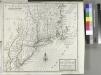
Maps of New York
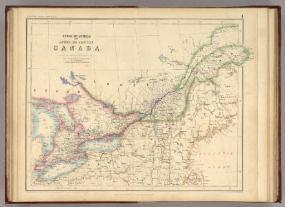
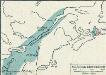
Upper Or Western And Lower Or Eastern Canada.
1 : 3453120 Rogers, Henry Darwin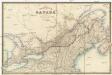
The province of Canada
Kanada Wyld, James James Wyld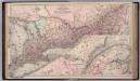
Canada. Provinces of Ontario and Quebec.
1 : 1550000 Colton, G.W.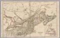
Upper Canada &c.
1 : 2154240 Arrowsmith, John
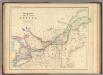
Canada.
1 : 4100000 Hughes, William
Canada &c.
1 : 7350000 Lucas, Fielding Jr.
Eastern Canada.
1 : 4800000 Schonberg & Co.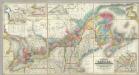
Map Of The Provinces Of Canada.
1 : 887040 Bouchette, Joseph
A Map Of Cabotia.
1 : 1457000 Whittle, J.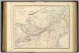
British North America. Sheet II, West.
1 : 2407680 Fullarton, A. & Co.
Map of the Provinces of Lower & Upper Canada.
1 : 887040 Wyld, James, 1812-1887
Karten - Skizzen für die Schul - Praxis
[Québec]
1 : 30000000 Québec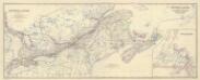
Composite: Canada.
1 : 2065500 Johnston, Alexander Keith, 1804-1871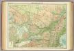
Ontario & Quebec.
1 : 2500000 John Bartholomew and Son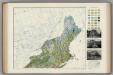
Soil Map of the United States, Section 1. Atlas of American Agriculture.
1 : 2500000 Marbut, Curtis F.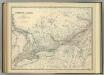
Central Canada.
1 : 2065500 Johnston, Alexander Keith
Northern provinces of the United States / drawn & engraved for Thomson's New general atlas, 1817 ; Hewitt Sc. ...
from Parts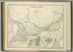
Central Canada.
1 : 2065500 Johnston, W. & A.K.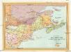
Sectional map indicating main automobile roads between Canada and United States
1 : 1900800 Kanada východní National Development Bureau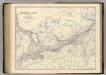
Canada W.
1 : 2065500 Johnston, Alexander Keith, 1804-1871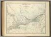
Central Canada.
1 : 2065500 Johnston, Alexander Keith
Canada, West Sheet.
1 : 2370000 Black, Adam & Charles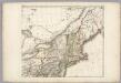
Sheet 2: United States of Nth. America.
1 : 1584000 Tardieu, P.F.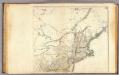
United States 4.
1 : 1750000 Arrowsmith, Aaron
Carte pour servir à l'itinéraire pittoresque du fleuve Hudson et des parties latérales de l'Amerique du Nord
1 : 4200000 Milbert, Jacques Gérard Gaugain, Henri
Upper Canada.
1 : 2200000 Arrowsmith, John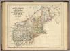
States Of Maine, N. Hampshire, Vermont, Massachusetts, Rhode Island, Connecticut, New York, Pennsylvania, And New Jersey.
1 : 3453120 Rogers, Henry Darwin
Map of the Vermont Central Rail Road and its connections from Smith's map of the United States.
from Parts