Maps of Boston
32. Ward 23 West Roxbury.
1 : 2400 Richards, L. J.
31. Ward 23 West Roxbury.
1 : 2400 Richards, L. J.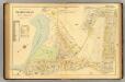
30. Ward 23 West Roxbury.
1 : 2400 Richards, L. J.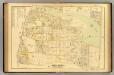
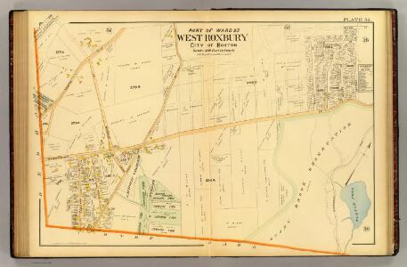
26. Ward 23 West Roxbury.
1 : 2400 Richards, L. J.
Map of West Roxbury : from official records, private plans and actual surveys
Hopkins, H. W. (Henry Whitmer), 1838-1920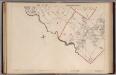
Part of the Metropolitan District (Boston), Massachusetts.
1 : 14400 Walker, O.W.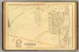
25. Ward 23 West Roxbury.
1 : 2400 Richards, L. J.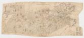
[Map of the town of Roxbury : surveyed by order of the town authorities
1 : 15840 Whitney, Charles s.n.
Map of the town of Dedham, Norfolk County, Massachusetts : surveyed by authority of the town
1 : 20000 Smith, N [s.n.]
Map of the town of Newton, Mass
1 : 20660 Woodward, E. F Annin, Smith, & Co.'s Lithogy.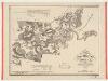
A map of the towns of Dorchester and Milton, 1831 : made under the direction of the town's committees for the use of the Commonwealth from actual surveys
1 : 20500 Baker, Edmund J Pendleton's Lithogy.
193. Los Angeles, San Francisco, Philadelphia, Boston, Chicago. The World Atlas.
1 : 250000 USSR (Union of Soviet Socialist Republics).
Rail road map : showing the street rail road routes in and leading from Boston, with the terminus of each road in suburban cities or towns
1 : 42240 Chase, J. G J.H. Bufford
Annexation map

Boston Harbor.
1 : 57000 Good, Charles E.
Dedham quadrangle, Massachusetts
1 : 62500 Geological Survey (U.S.) U.S. Geological Survey
Boston quadrangle, Massachusetts
1 : 62500 Geological Survey (U.S.) U.S. Geological Survey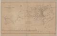
Map of the Boston water works
1 : 38400 Perkins, Charles Tappan & Bradford's Lith.
Boston and vicinity.
1 : 39600 Smith, R. P.
Boston.
1 : 15500 Rand McNally and Company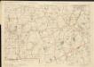
Massachusetts

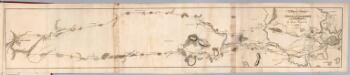
A plan of the town and harbour of Boston, and the country adjacent with the road from Boston to Concord shewing the place of the late engagement between the King's troops & the provincials ...
1 : 120000 De Costa, J. De Costa, J.
Chart of Boston Harbor and Massachusetts Bay : with map of the adjacent country
1 : 65400 E.P. Dutton (Firm) E.P. Dutton & Co.
Map of the Metropolitan District of Boston : showing local public reservations, the holdings of the Metropolitan Park Commission and additions which have been proposed
1 : 62500 Massachusetts. Metropolitan Park Commission Metropolitan Park Commission
Map of the city and vicinity of Boston, Massachusetts : from original surveys
1 : 39600 Sidney, J. C. (James C.) J.B. Shields
Map of Boston and its vicinity from actual survey

Map of Boston and its vicinity from actual survey

Map of Boston and its vicinity from actual survey

Boston
1 : 125000