Maps of Boston
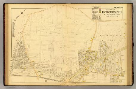
13. Ward 24 Dorchester.
1 : 2400 Richards, L. J.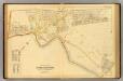
12. Ward 24 Dorchester.
1 : 2400 Richards, L. J.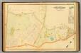
18. Ward 23 West Roxbury.
1 : 2400 Richards, L. J.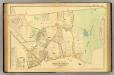
19. Ward 23 West Roxbury.
1 : 2400 Richards, L. J.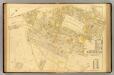
10. Ward 24 Dorchester.
1 : 2400 Richards, L. J.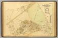
11. Ward 24 Dorchester.
1 : 2400 Richards, L. J.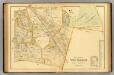
24. Ward 23 West Roxbury.
1 : 2400 Richards, L. J.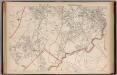
Part of the Metropolitan District (Boston), Massachusetts.
1 : 14400 Walker, O.W.
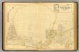
Map of West Roxbury : from official records, private plans and actual surveys
Hopkins, H. W. (Henry Whitmer), 1838-1920
Boston South
1 : 25000
Boston South
1 : 24000
Boston South
1 : 25000
Boston South
1 : 24000
Boston South
1 : 24000
Boston South
1 : 24000
Boston South
1 : 25000
Boston South
1 : 31680
Boston South
1 : 31680
Boston South
1 : 24000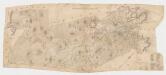
[Map of the town of Roxbury : surveyed by order of the town authorities
1 : 15840 Whitney, Charles s.n.
Map of the town of Quincy, Norfolk County, Mass. : surveyed by order of the town
1 : 15000 Walling, Henry Francis, 1825-1888 H.F. Walling & Co.
Map of Boston : from the latest surveys
Sampson, Davenport & Co Sampson, Davenport & Co.
Map of Boston : from the latest surveys
1 : 12000 Sampson, Davenport & Co Sampson, Davenport & Co.
Map of Boston for 1875
1 : 19800 Sampson, Davenport & Co Sampson, Davenport, & Co.
Boston.
1 : 19800 Sampson, Murdock & Co.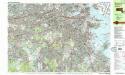
Boston South
1 : 25000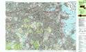
Boston South
1 : 25000
Boston South quadrangle, Massachusetts
1 : 62500 Geological Survey (U.S.) U.S. Geological Survey
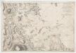
Carte de la ville, baye et environs de Baston