Maps of Cambridge
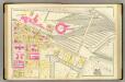
11. Ward 1.
1 : 1200 Bromley, George Washington; Bromley, Walter Scott
Sketch of the Action on the Heights of Charlestown.
Melish, John
Boston, Birthplace of the Telephone : A Pictorial Map of the Down Town Area
Chase, Ernest Dudley, 1878-1966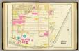
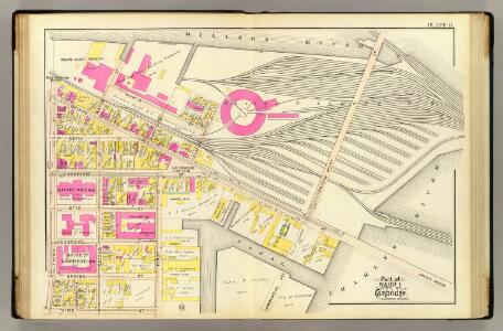
10. Wards 1-2.
1 : 1200 Bromley, George Washington; Bromley, Walter Scott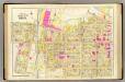
12. Wards 1-3.
1 : 1200 Bromley, George Washington; Bromley, Walter Scott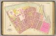
6. Ward 8.
1 : 1200 Bromley, George Washington; Bromley, Walter Scott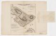
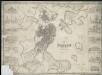
A plan of the action at Bunkers Hill on the 17th of June 1775 between His Majesty's troops, under the command of Major General Howe, and the American forces (without overlay)
1 : 4800 Page, Thomas Hyde, Sir, 1746-1821 Published by the author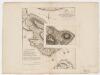
A plan of the action at Bunkers Hill on the 17th of June 1775 between His Majesty's troops, under the command of Major General Howe, and the American forces (with overlay)
1 : 4800 Page, Thomas Hyde, Sir, 1746-1821 Published by the author
An accurate plan of the town of Boston and its vicinity : exhibiting a ground plan of all the streets, lanes, alleys, wharves, and public buildings in Boston, with the names and description thereof, likewise all the flats and channels between Boston and Charlestown, Cambridge, Roxbury & Dorchester with the two bridges and causeway, and the boundary lines beween Boston and the above mentioned towns from ...
1 : 4170 Carleton, Osgood, 1742-1816 Published and sold by Osgood Carleton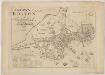
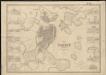
The town of Boston in New England
1 : 5600 Bonner, John, ca. 1643-1726 George G. Smith
Plan of Boston comprising a part of Charlestown and Cambridge
1 : 7310 Smith, George Girdler, 1795-1878 George G. Smith
Plan of Boston comprising a part of Charlestown and Cambridgeport
1 : 6090 Fuller, Stephen P Annin & Smith ; J.V.N. Throop
Plan of Boston comprising a part of Charlestown and Cambridge
1 : 7380 Smith, George Girdler, 1795-1878 George G. Smith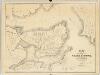
Plan of the city of Charlestown : made by order of the City Council from actual survey
1 : 4800 Felton & Parker J.H. Bufford's Lithogy.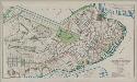
Plan of Boston proper : showing changes in street and wharf lines, 1795 to 1895
1 : 4800 Perkins, Charles Carroll H.H. Lloyd
Plan of Boston comprising a part of Charlestown and Cambridge
1 : 7310 Smith, George Girdler, 1795-1878 George G. Smith
Boston and Adjacent Cities.
1 : 20000 Colton, G.W.
A plan of those parts of Boston, and the towns in its vicinity, with the waters and flats adjacent, which are immediately or remotely connected with the contemplated design of erecting perpetual tide-mills
Plan of Boston with parts of the adjacent towns
Plan of Boston with parts of the adjacent towns

Boston.
1 : 16500 Rand McNally and Company
Boston, pt. of Charlestown, Cambridge.
1 : 7000 Smith, George G.
Boston and Adjacent Cities.
1 : 20000 Colton, G.W.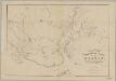
Rail-road crossings and termini in the vicinity of Boston : compiled under the direction of the commissioner appointed by the governor to report upon a plan or plans for avoiding said crossings
1 : 7200 Perkins, Charles E., 1951- Tappan & Bradford's Lithogy.
A New and Complete Map of the city of Boston, with part of Charlestown, Cambridge, & Roxbury

Boston and Adjacent Cities.
1 : 19500 Colton, G.W.
Boston and Adjacent Cities.
1 : 20000 Colton, G.W.
New map of Boston : with squares and numbers after the Baedeker plan
1 : 8350 Boston Map Co.
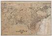
Map of the city of Cambridge, Middlesex County, Massachusetts
1 : 6000 Walling, Henry Francis, 1825-1888 Geo. L. Dix