Maps of Carpathian Mountains
Hungary, Transilvania.
1 : 1650000 Bowen, Emanuel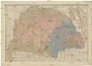
Charte von den kaiserlich oesterreichischen ungarischen Ländern
1 : 1230000 Maďarsko Streit, Friedrich Wilhelm im Verlage des Geograph. Instituts
Hvngariae descriptio / Wolfgango Lazio avct
1 : 1400000 1 Karte : Kupferdruck ; 32 x 49 cm Lazius, Wolfgang [Verlag nicht ermittelbar]
Hungary, Transilvania &c.
1 : 1470000 Lizars, Daniel
Charte von den kaiserlich Oesterreichischen Ungarischen Ländern
1 : 1240000 Maďarsko Streit, Friedrich Wilhelm im Verlage des Geograph. Instituts
Plan des Hoch Geföls Korpsona
Mollova mapová sbírka Geyer
Novissima regni Hungariae potamographica et telluris productorum tabula
1 : 991000 Maďarsko Junker, Christoph Joh. Matth. Korabinsky
Ungarn, Siebenburgen, Slavonien, Kroatien.
1 : 1850000 Stieler, Adolf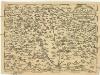
Regni Hvngariae
1 : 4000000 Uhersko
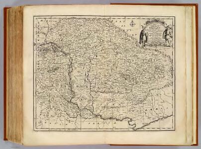
Hungary and Transilvania
1 : 2800000 Mollova mapová sbírka Moll, Herman Moll, Hermann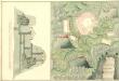
Plan von Folsi Bania
Mollova mapová sbírka Geyer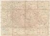
Magyarország úthálózatának térképe
1 : 1300000 Maďarsko Homolka, Josef Eggenberger féle könyvkereskedés (Hofmann Alfréd)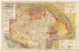
A Magyar birodalom és a szomszédos országok határos területeinek földtani térképe
1 : 900000 Maďarsko Lóczy, Lajos Papp, Károly Magyar földrajzi társaság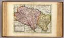
Hungary and Transilvania.
1 : 2800000 Moll, Herman, d. 1732
Länder der Ungarischen Krone: Ungarn, Siebenbürgen, Slavonien und ein Theil von Kroatien
Handatlas über alle Theile der Erde und über das Weltgebäude Stieler, Adolf Justus Perthes
Karpatenland
1 : 11200000 Donau-Karpaten-Gebiet
Charte von den Kaiserlich Oesterreichischen Ungarischen Ländern
1 : 1200000 entworfen u. gezeichnet von F. W. Streit Weimar : Verlag des Geograph. Instituts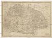
Ungarn sam[m]t der vereinigten Ländern und Siebenbürgen
Maďarsko Hocke, Jan Kapras, Jan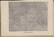
Karta teatra vojny v Vengrīi
Ungarn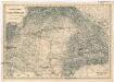
Uibersichts Karte des Kriegsschauplatzes von Ungarn und Siebenbürgen
1 : 1470000 Maďarsko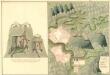
Plan der Bergstadt Terestian
Mollova mapová sbírka Geyer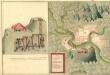
Plan des Gold und Silber Berg Adamos
Mollova mapová sbírka Geyer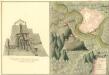
Plan der Bergstat Bogan
Mollova mapová sbírka Geyer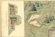
Plan der Bergstadt Abrugbania
Mollova mapová sbírka Geyer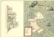
Plaan des Haupt Bergwerg Maidanpeg
Mollova mapová sbírka Geyer
Carte Particuliere De La Hongrie De La Transilvanie De La Croatie Et De La Sclavonie
1 : 1400000 Mollova mapová sbírka Delisle, Guillaume Schenk, Peter II
Carte Particuliere De La Hongrie De La Transilvanie De La Croatie Et De La Sclavonie
1 : 1400000 Mollova mapová sbírka Delisle, Guillaume L'Isle, Guillaume de
Uhry a Sedmihradsko
1 : 3700000 Maďarsko nákladem u Marka Berri
Postkarte des Königreichs Ung.Übersciht von Wien über Ofen bis Kronstadt ; und von Venedig, Triest, Fiume bis Lemberg und Brody
Ungarn Kroatien Postroute Verkehrsweg
Hongrie, Transilvanie, Croatie, Sclavonie.
1 : 1390000 L'Isle, Guillaume de, 1675-1726