Maps of Netherlands

Seven United Provinces.
1 : 1550000 Bowen, Emanuel
Les Provinces Confedereés du Pais-Bas
1 : 680000 Mollova mapová sbírka Aa, Pieter van der Aa, Peter vander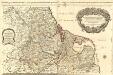
Les Dix-Sept Provinces des Pays-Bas
1 : 1050000 Mollova mapová sbírka Sanson, Guillaume Jaillot, Alexis Hubert
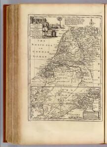
Seven United Provinces.
1 : 1460000 Bowen, Frances
Karte der itzo vereinigten Niederlande
1 : 990000 Nizozemsko
Belgica foederata complectens septem provincias, ducatum Geldriae, comitatus Hollandiae et Zeelandiae dioec. traject. transisul. Groningam et Frisiam et circumjacentes provincias mappa geographica
1 : 610000 Belgie Lotter, Tobias Conrad per Tobia[m] Conr. Lotter
Belgica foederata complectens septem provincias, ducatum Geldriae, comitatus Hollandiae et Zeelandiae dioec. traject. transisul. Groningam et Frisiam et circumjacentes provincias mappa geographica
1 : 610000 Belgie Lotter, Tobias Conrad Lotter, Matthäus Albrecht per Tobia[m] Conr. Lotter
Holland.
1 : 1048000 Hughes, William
Comitatus Hollandiae denuo forma leonis
1 : 570000 Alkmaar (Nizozemnsko) Visscher, Claes Jansz. Nassau-Usingen, Karel van a Nicolao Iohannis Visscher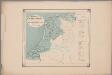
[25]. Nederland : de dijken weggedacht ..., uit: Geologische kaart van Nederland : schaal van 1:200.000 / door W.C.H. Staring ; uitgevoerd door het Topographisch Bureau van Oorlog ; uitgegeven op last van Zijne Majesteit Den Koning
Annotatie: Impressum ontleend aan omslag; Kaart "Nederland de dijken weggedacht" [kaart 25] en kaart 13 (bladwijzer) vermelden het jaar 1869; Kaart 'Limburg en de Hesbaije' (bladnr. 26) vermeldt het jaar 1868; Blad 5/9 ontbreekt Topographische Inrichting, 's-Gravenhage; Topographisch Bureau Haarlem : A.C. Kruseman
Holland.
1 : 1290000 Finley, Anthony
Belgium foederatum
1 Karte : Kupferdruck ; 47 x 55 cm Seutter Matthäus Seutter
Des Burgundischen Creisses Nordlicher Theil oder Vereinigte Niederlande
1 : 2200000 Mollova mapová sbírka Weigel, Christoph Weigel, Christoph I. - dědici
Bladwijzer van de kaarten op de schaal van 1:25 000, 1:50 000 en 1:200 000
1 : 600000 Nizozemsko Topogr. Inrichting
Holland.
1 : 1330560 Tallis, J. & F.
Algemeene kaarte der Nederlandsche Republiek, verdeeld naar derzelver kerkelyk bestuur
door W.A. Bachiene ... J. van Jagen sculps. 1767. Amsterdam : bij D. onder de Linden
Holland.
1 : 1300000 Darton, William
Belgium foederatum
1 : 640000 Indonésie Seutter, Matthäus studio [Mattha]ei Seutteri
Nieuwe kaart der Vereenigde Nederlanden
1 : 900000 Amsterdam : by Isaak Tirion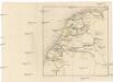
[Nizozemsko]
Nizozemsko Bilderdyk, W Veelwaard, D.

Overzichtskaart van den Topographischen atlas van het Koningrijk der Nederlanden op de schaal van 1:200.000
1 : 1000000 titelvariant: Bladwijzer van den Topographischen atlas van het Koninkrijk der Nederlanden op de schaal van 1:200.000; Topographische atlas van het Koningrijk der Nederlanden op de schaal van 1:200.000; Annotatie: Omslagtitel: Bladwijzer van den Topographischen atlas van het Koninkrijk der Nederlanden op de schaal van 1:200.000 ['s-Gravenhage : Topographische Inrichting]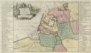
Descriptio veteris Agri Batavi et Frisi omnisque regionis quae hodie est in dicione VII. Foederatorvm cis et ultra Rhenvm
1 : 1100000 Mollova mapová sbírka Alting, Menso
Belgii Pars Septentrionalis communi nomine Vulgo Hollandia nuncupata
1 : 650000 Mollova mapová sbírka Homann, Johann Baptist Homann, Johann Baptista - dědici
Belgium Foederatum
1 : 620000 Mollova mapová sbírka Visscher, Nicolaes Schenk, Peter II
Foederatae Belgicae tabvla
1 : 728000 Limburg (Belgie) Wit, Frederick de F. de Wit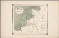
25. Nederland : de dijken weggedacht ..., uit: Geologische kaart van Nederland / door W.C.H. Staring ; bew. aan de Topographische Inrichting
1 : 200000 Winand Carel Hugo Staring 1808-1877; Topographische Inrichting, 's-Gravenhage 's-Gravenhage : Belinfante
Kaart der bosschen in Nederland / bewerkt door H. Blink ; uitgegeven door de afdeeling Amsterdam der Nederlandsche Heidemaatschappij, met subsidie van het hoofdbestuur
1 : 400000 Annotatie: Met lijst: Gemeenten, waar de uitgestrektheid der bosschen 20 en meer procent van de oppervlakte bedraagt; Annotatie geografische gegevens: Legenda Hendrik Blink 1852-1931; Nederlandsche Heidemaatschappij. Afdeeling Amsterdam [Amsterdam : Afdeeling Amsterdam der Nederlandsche Heidemaatschappij] / ('s-Hage : lithographie en kleurendruk van J. Smulders & C°.)
BELGICA | FOEDERATA
[Amsterdam : Joan Blaeu]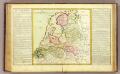
La Hollande.
1 : 1100000 Clouet, J. B. L. (Jean-Baptiste Louis), b. 1730