Maps of Colorado Plateau
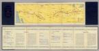
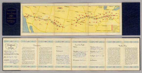
Air Route from Los Angeles to Columbus.
1 : 5702400 Transcontinental Air Transport, Inc.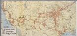
The Atchison, Topeka and Santa Fe railway system
1 : 3500000 New York, N.Y. : Montross & Clarke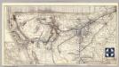
Santa Fe.
1 : 9380000 Atchison, Topeka, and Santa Fe Railroad Company
Route of the California Limited.
1 : 20000000 Atchison, Topeka, and Santa Fe Railroad Company
Charte pour servir au voyage des cap.es Lewis et Clarke a l'ocean Pacifique 1804
Severní Amerika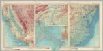
United States of America - California. U.S.A. - Selected Areas. Atlantic Coastal Plain - Central. Pergamon World Atlas.
Polish Army Topography Service
Texas.
1 : 7200000 Radefeld, Carl Christian Franz, 1788-1874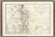
Carte Generale Du Royaume De La Nouvelle Espagne.
1 : 3000000 Humboldt, Alexander von, 1769-1859
Texas
Grosser Hand-Atlas über alle Theile der Erde in 170 Karten Meyer, J. Verlag des Bibliographischen Instituts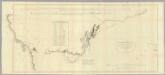
Military Reconnaissance Of The Arkansas Rio Del Norte And Rio Gila.
1 : 1520640 Emory, William H.
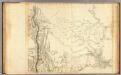
Map of the Indian Territory, Northern Texas and New Mexico.
from Supplement to the New York observer.
Map of The Internal Provinces of New Spain.
1 : 4815360 Pike, Zebulon Montgomery
Nebraska And Kansas.
1 : 3850000 Colton, J. H.
Spojené státy severoamerické II. Prostřední část
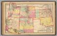
Kansas, and Arizona, Colorado, New Mexico, Utah, and Indian Territory.
1 : 3000000 Lloyd, H.H.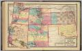
Kansas, and Arizona, Colorado, New Mexico, Utah, and Indian Territory.
1 : 3000000 Walling, H. F.
Territories of New Mexico and Utah (and Nevada and Arizona).
1 : 4400000 Colton, G.W.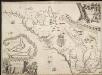
A new discription of Carolina by the order of the Lords Proprietors.
1 : 1648000 Covers Atlantic coast from St. Augustine to James Town. Relief shown pictorially. Oriented with north to right. Includes inset [ca. 1:190,080]: "Charles Town, Ashley and Cooper rivers" Ogilby, John, 1600-1676.;Moxon, J. (James) [John Ogilby]
Indian Territory, Northern Texas and New Mexico.
1 : 3600000 Gregg, Josiah, 1806-1850
Territories Of New Mexico and Utah.
1 : 4430000 Colton, G.W.
U.S.A. Great Plains South, Plate 109, Vol. V
1 : 2500000 Bartholomew, John
[Die Vereinigten Staaten von Amerika in 6 Blättern, Blatt 5]
Adolf Stieler's Handatlas über alle Theile der Erde und über das Weltgebäude Stieler, Adolf Justus Perthes
Indian Terr., N. Texas, N.M.
1 : 3500000 Morse, Sidney E. (Sidney Edwards), 1794-1871
Commercial Map, Chicago to Denver.
1 : 3950000 Rand McNally and Company
Nebraska and Kansas.
1 : 3850000 Colton, J. H.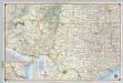
Shell Sectional Map No. 10 - Southwestern States.
1 : 3104640 Shell Oil Company
Map showing the lands assigned to emigrant Indians west of Arkansas & Missouri / prepared at the Topographical Bureau Feby. 23d, 1836, [by] R. Jones, Adj. Gene.
from Parts
Texas. Kentucky. Tennessee.
1 : 3743000 Gray, Ormando Willis
(United States) Denver to Chicago.
1 : 3802000 Rand McNally and Company