Maps of United States
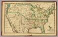
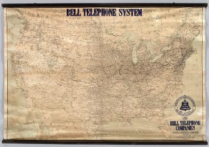
Lines Of The Bell Telephone Companies. United States And Canada.
1 : 2471040 American Telephone and Telegraph Company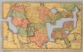
Map of the United States and Canada.
1 : 11404800 Merriam, Moore & Co.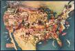
Paul Sample's America: Its Soil
This bird's-eye-view map shows scenes of land use and farming superimposed on a map of the United States. Agricultural scenes of farming, livestock, and crops are depicted. Sample, Paul Associatedd American Artists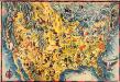
The Covarrubias America: a decorative map of the United States of America
This pictorial bird's-eye-view map shows the United States of America with parts of Canada and Mexico. Landscape, trade, industry, points of interest, people, and animals are depicted. Covarrubias, Miguel Edward Stern & Co.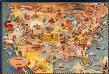
Bohrod's America, its history
This map shows scenes from America's history with names of historical events superimposed on a map of the United States. Bohrod, Aaron Associated American Artists
United States.
1 : 8183000 Hammond, C.S.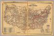
United States.
1 : 10700000 Rand McNally and Company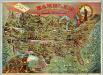
Rambles Through Our Country.
1 : 6842880 American Publishing Company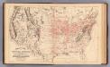
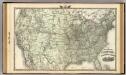
Railroad map U.S.
1 : 7850000 Mitchell, Samuel Augustus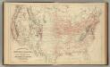
Railroad map U.S.
1 : 7850000 Mitchell, Samuel Augustus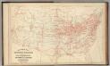
Railroad map U.S.
1 : 7850000 Mitchell, Samuel Augustus Jr.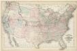
Walling and Grey's map of the United States and territories

Vereinigte Staaten v. Nord-America.
1 : 11500000 Flemming, Carl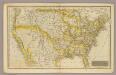
United States.
1 : 11200000 Morse, Jedidiah; Morse, Sidney E. (Sidney Edwards), 1794-1871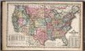
United States.
1 : 8750000 Mitchell, Samuel Augustus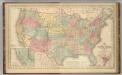
United States.
1 : 8750000 Mitchell, Samuel Augustus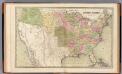
United States.
1 : 7920000 Goodrich, S.G.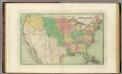
United States.
1 : 8236800 Bradford, Thomas G.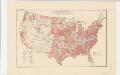
Areas covered by the soil survey, completed to January 1934
1 : 7900000 Includes numbered list of reconnaissance surveys. "Atlas of American Agriculture, Soils, Plate 1." United States. Bureau of Chemistry and Soils. [Washington, D.C.?] : The Bureau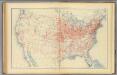
60. Railroad systems 1890.
1 : 7000000 Gannett, Henry, 1846-1914; United States. Census Office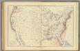
59. Navigable rivers, routes 1890.
1 : 7000000 Gannett, Henry, 1846-1914; United States. Census Office
62. Valuation, real estate, personal property 1890.
1 : 14200000 Gannett, Henry, 1846-1914; United States. Census Office
61. Valuation, real estate, personal property 1890.
1 : 14200000 Gannett, Henry, 1846-1914; United States. Census Office
63. Taxation, indebtedness 1890.
1 : 14200000 Gannett, Henry, 1846-1914; United States. Census Office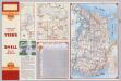
Various Regions and Cities in Arizona.
Shell Oil Company
Colton's plans of U.S. harbors, showing the positions & vicinities of the most important fortifications on the sea-board and in the interior

H.H. Lloyd & Co's campaign military charts showing places of interest

Lloyd's military maps: showing the principal places of interest
New railroad map of the United States, and Dominion of Canada.
1 : 7000000 Warner & Beers