Maps of Coast Ranges
Cote, N.O. de l'Amerique. 3.
1 : 3100000 La Perouse, Jean-Francois de Galaup, comte de, 1741-1788
Chart of the North West Coast of America.
1 : 3040000 La Perouse, Jean-Francois de Galaup, comte de, 1741-1788
U.S. West of Mississippi R. 1.
1 : 2000000 Freyhold, Edward; Warren, Gouverneur Kemble, 1830-1882; United States. Army. Corps of Engineers
Railroad map of Oregon, California, and Nevada.
1 : 2508000 Gray, Ormando Willis
Rand McNally Junior Road Map California and Nevada.
1 : 3548160 Rand McNally and Company
California, Nevada, Oregon.
1 : 2000000 Williamson, R.S.
The Coast of N.W. America
1 : 1400000 Vancouver, George, 1757-1798
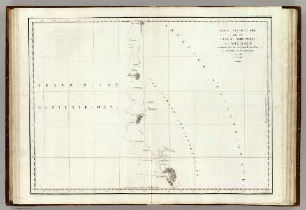
Cote NO, l'Amerique 2.
1 : 1500000 Vancouver, George, 1757-1798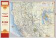
Shell Highway Map of California (northern portion).
1 : 1330560 Shell Oil Company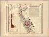
Nouvelle Californie. Amer. Sep. 46.
1 : 1641836 Vandermaelen, Philippe, 1795-1869
Pacific Coast subjects.
1 : 7800000 United States. Census Office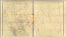
California, Nevada (upper)
1 : 696960 Von Haake, A.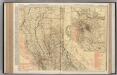
California (Northern Section).
1 : 1140000 Rand McNally and Company
California and Nevada. North Portion.
1 : 1290000 Asher & Adams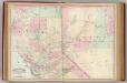
Calif., Nev. north.
1 : 1267200 Asher & Adams
California and Nevada.
1 : 2267000 Gray, Ormando Willis
Shell Sectional Map No. 12- Pacific Southwest States.
1 : 1964160 Shell Oil Company
County map of California
1 : 3900000 Mitchell, Samuel Augustus Jr.
Washington, Oregon, California, Idaho.
1 : 1518000 Rand McNally and Company
Map of northern California showing general plan for the reclamation of the entire Sacramento and San Joaquin Valleys
1 : 11450000 Brown line print. Shows which areas are to be irrigated by which specific rivers. "Map A" Marshall, R. B. (Robert Bradford). 1867-1949. [S.N.
California.
1 : 2560000 Rand McNally and Company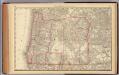
Oregon.
1 : 1900000 Rand McNally and Company
Panoramic perspective of Central Valley Project of California
Covers California from the Oregon border to the Mohave Desert. Relief shown pictorially and by spot heights.Shows canals, power transmission lines, pumping plants, dams, etc. United States. Bureau of Reclamation, A A Abel [Washington, D.C.] : U.S. Dept. of the Interior, Bureau of Reclamation.
California, Nevada, Utah, Colorado, Arizona and New Mexico.
1 : 2090880 Colton, G.W.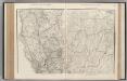
California. Nevada.
1 : 1341000 Rand McNally and Company
California.
1 : 1900800 Immigration Association of California
County Map Of California.
1 : 3801600 Mitchell, Samuel Augustus
Map of California.
1 : 1770000 California State Board of Trade
Map of California.
1 : 1600000 Southern Pacific Company
Map of California.
1 : 2100000 California State Board of Trade