Maps of Germany
Germania Antiqua.
1 : 2300000 Robert de Vaugondy, Gilles, 1688-1766
Empire d'Allemagne, Hongrie, Gallicie, Prusse, Provinces-Unies de Pays-Bas; en 1789.
1 : 3500000 Brue, Adrien Hubert, 1786-1832
(Villes Anseatiques)
1 : 2900000 Dangeau, abbe de, 1643-1723
Germany, Austria, Bohemia.
1 : 2600000 Cary, John, ca. 1754-1835
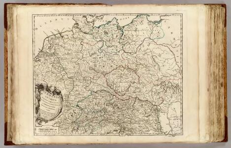
Germania Augustiniana
1 : 3700000 Mollova mapová sbírka Seutter, Matthäus Seutter, Matthäus
Neueste Post Karte von Deutschland und dessen angrenzenden Länder
Evropa střední Jättnig, Karl Simon Schropp
Deutschland
Plastischer Schul-Atlas über alle Theile der Erde : in 24 Karten Woldermann, G Verlag von P. Eckerlein
Neueste Post-Karte von Deutschland und den angrenzenden Laendern
1 : 1700000 Maďarsko Mollo, Tranquillo T. Mollo
Deutschland nach seiner neuesten Grenz-Berichtigung
1 : 2350000 Evropa střední Mollo, Tranquillo T. Mollo
Deutschland nach seiner neuesten Grenz-berichtigung
1 : 2350000 Evropa střední Mollo, Tranquillo T. Mollo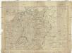
Deutschland nach seiner neuesten Grenz-Berichtigung
1 : 2370000 Evropa střední Mollo, Tranquillo bey T. Mollo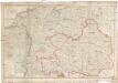
Neueste Post Karte von ganz Deutschland
1 : 1460000 Evropa střední Müller, Franz Artaria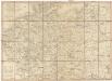
Post Karte von Deutschland und den angraenzenden Laendern vorzüglich der preussischen Staaten
1 : 1700000 Evropa střední Mollo, Tranquillo T. Mollo
L'Allemagne 843 a 911.
1 : 6300000 Houze, Antoine Philippe
Germany.
1 : 6400000 Tanner, Henry S.
Germania magna, Rhaetia, Noricum
1 : 3800000 Evropa střední Spruner, Karl von Behrens, W. Justus Perthes
Nova Germaniae Descriptio
1 : 3100000 Mollova mapová sbírka Janssonius, Johannes Janssonius, Johannes I
Reise Karte von Deutschland
Evropa střední Julius, E. Vieweg, Friedrich Friedrich Vieweg
La Germanie 741 a 843.
1 : 6300000 Houze, Antoine Philippe
Die großen Friedensschlüsse I (1648 - 1721). 1. Westfälischer Friede 1648
1 : 20000000 Mitteleuropa Westfälischer Friedenskongress
Mittelbach's Automobilkarte von Mitteleuropa
1 : 1500000 Evropa střední Mittelbach's Verlag
B.Z. - Karte von Oesterreich

Die deutsche Bundesstaaten
1 : 3500000 Evropa střední Raffelsperger, Franz in Typographischen Landkarte-Verlage
Post- & Reise-Karte von Deutschland und den nachbar Staaten
Evropa střední Handtke, Friedrich Flemming, C. C. Flemming
Post- & Reise-Karte von Deutschland und den nachbar Staaten
Evropa střední Handtke, Friedrich Weber, H. C. Fleming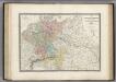
Allemagne en 1789.
1 : 3580000 Levasseur, E.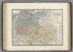
Europe Centrale.
1 : 3500000 Levasseur, E.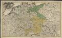
Imperii romano-germanici in suos status et circulos divisi tabula generalis
1 : 1750000 Ultraject : edita per Cornelium Kribber
Deutschland
Neuer Handatlas über alle Theile der Erde Kiepert, Heinrich Verlag von Dietrich Reimer