Maps of Pontic Steppe
Das Russische Reich in Europa Sud.
1 : 4475000 Stein, Christ. Gottfr. Dan.
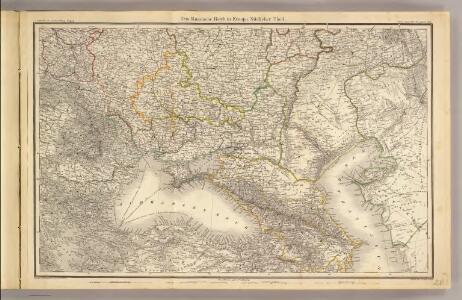
Des europäischen Russlands südlicher Theil
Allgemeiner Atlas [Walch, Johannes] im Verlag bei Johannes Walch
Carte des gîtes miniers de la Russie d'Europe
1 : 4200000 Süd-Blatt Möller, Valerian von Département des Mines de Russie
Verbreitung der Slaven um 1900
Osteuropa Slawen Anton, J.
Southern Russia.
1 : 6000000 John Bartholomew and Son
[Secunda Asie tabula] [Karte], in: Clavdii Ptholomei Viri Alexandrini Cosmographie, S. 167.
1 Karte aus Atlas Nicolaus Germanus [und Ptolemaeus, Claudius]
Standorte der höheren Kommandos in Europa und Kaukasus
Russland Russland / Europäischer Teil Kaukasus Militär
Uebersicht über die Stabsquartiere der russischen Armee
Russland Militär
Secunda Asiae Tabula [Karte], in: Claudii Ptolemei viri Alexandrini mathematice discipline philosophi doctissimi geographie opus [...], S. 196.
1 Karte aus Atlas Waldseemüller, Martin [und Ptolemaeus, Claudius] Übelin, Georg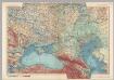
U.S.S.R. in Europe - South. Pergamon World Atlas.
1 : 5000000 Polish Army Topography Service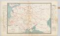
Spoorwegkaart van Rusland / naar de nieuwste bronnen vervaardigd door J. Pik
1 : 2500000 Annotatie: Met informatie over Russische spoorwegmaatschappijen en over het Russische geld; Annotatie geografische gegevens: Met drie maatstokken: Duitsche mijlen, Kilometers en Wersten J. Pik Groningen : De Financier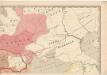
Evropa raného středověku: do konce VI. století po Kr.
Kašpar, Jan
Europe Orientale, Feuille Sud.
1 : 5000000 Vivien St Martin, L.
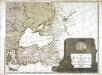
Dacia Or., Sarmatia, Caucasus, Scythia Int. Imaum / J.E. Knittel sculps
1 : 5100000 1 Karte : Kupferdruck ; 45 x 58 cm Campe, Friedrich Campius
Secunda Asie Tabula [Karte], in: [Clavdii Ptholomei Cosmographi ...], S. 302.
1 Karte aus Atlas Nicolaus Germanus [und Ptolemaeus, Claudius]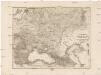
Dacia or., Sarmatia, Caucasus, Scythia int. Imaum
1 : 800000 Dácie Reichard, Christian Gottlieb Campius, D. a D. Campio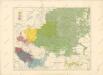
Národopisná mapa Slovanstva
Karte von Europa, 4
4 Blätter : 52 x 70 cm Verlag der Königlich-Preussischen Academie-Kunst- und Buchhandlung
Composite: Sheets 1 - 16 Kriegsstrassen Karte eines Theiles von Russland
1 : 1400000 Schubert, Friedrich Theodor
Verbreitung der Slaven um 1400
Osteuropa Slawen Anton, J.
Russland in den Jahren von 900 bis 966
1 : 15000000 Russland / Europäischer Teil
Russland in den Jahren von 966 bis 1114
1 : 15000000 Russland / Europäischer Teil
Carte de La Russie D'Europe.
1 : 6700000 Vivien de St Martin, L.
Feuille 21 (G III), uit: Carte géologique internationale de l'Europe : la carte, votée au congrès géologique international de Bologne en 1881, est exécutée conformément aux décisions d'une commission internationale, avec le concours des gouvernements, sous le dir. de M.M. Beyrich et Hauchecorne
Annotatie: Blad 48 gamme des couleurs; blad 49: bladwijzer en titelblad Heinrich Ernst Beyrich 1815-1896; Wi. Hauchecorne Berlin : Reimer / (Berlin: Institut lithographique)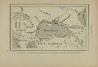
Pénétration et marche des Avars en Europe orientale
Osteuropa Avaren Völkerwanderungszeit
Tabula Asiae II. [Karte], in: Geographia universalis vetus et nova complectens Claudii Ptolemaei Alexandrini enarrationis libros VIII, S. 269.
1 Karte aus Atlas Münster, Sebastian [und Ptolemaeus, Claudius]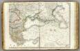
Europe 4.
1 : 3850000 Brue, Adrien Hubert, 1786-1832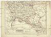
Eur. Russland
Rusko jižní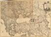
Le Theatre de la Guerre entre les deux puissans Empires de Russie et de Turquie, tant en Europe qu'en Asie :
1 : 2200000 Mollova mapová sbírka Jaeger, Johann Wilhelm Abraham Facius, Johann Gottlieb Jäger, Johann Wilhelm Abraham