Maps of Allegheny Plat.
United States ... North Eastern States.
1 : 2851200 Fullarton, A. & Co.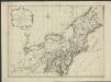
Nieuwe en nauwkeurige kaart van een gedeelte van Noord America, behelzende Nieuw England, New York, Pensylvania, New Jersey, Connecticut, Rhode Island, een stuck van Virginia, Kanda en Halifax, ter opheldering der reizen van den Heer P. Kalm
1 : 2000000 C.J. de Huyser direx. P. Mol geletterdt Te Utrecht : by de boekverkopers J. v. Schoonhoven & Comp. en G. v. d. Brink jz.
Vereinigte Staaten von Nord-Amerika in 6 blattern, bl. 3

Northern provinces of the United States / drawn & engraved for Thomson's New general atlas, 1817 ; Hewitt Sc. ...
from Parts
[Die Vereinigten Staaten von Amerika in 6 Blättern, Blatt 3]
Adolf Stieler's Handatlas über alle Theile der Erde und über das Weltgebäude Stieler, Adolf Justus Perthes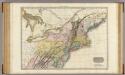
United States of America, northern part.
1 : 2100000 Pinkerton, John, 1758-1826
[Die Vereinigten Staaten von Nord-Amerika, Blatt 3]
Handatlas über alle Theile der Erde und über das Weltgebäude Stieler, Adolf Justus Perthes
Skeleton map of the rail-roads between Cape Canso and St. Louis

Nieuwe en nauwkeurige kaart van een gedeelte van Noord Amerika : behelzende Nieuw Engeland, New York, Pennsylvania, New Jersey, Connecticut, Rhode Island, een stuk van Virginia, Kanada en Halifax, ter opheldering der reizen van den Heer P. Kalm / C.J. de
from Reis door Noord Amerika, gedaan door den Heer Pieter Kalm ... Vercierd met koperen platen ...
Vereinigte Staaten Von Nord-Amerika In 6 Blattern, Bl. 3.
1 : 3700000 Petermann, A.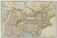
New travelling and commercial map of the Canadas: from the Sault of St. Marie to the river Saguenay, and a large section of the United States of America / compiled from the latest surveys and most approved authorities ... by his obliged obedient humble servant David Taylor, R.N., March 1834; engraved by S. Stiles & Co.
from Parts David Taylor; S. Stiles & Co.,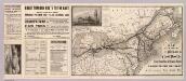
Chicago & Grand Trunk R'y.
1 : 3830000 Chicago and Grand Trunk Railway Company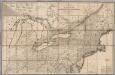
Map of the Canadas.
1 : 1267200 Taylor, David
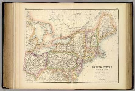
United States.
1 : 3380000 Sharpe, J.
Nördlicher Theil der Vereinigten Staaten
Stieler's Hand-Atlas Stieler, Adolf bei Justus Perthes
130-31. Ohio, Penn., N.Y., Vt., N.H., W.Va., Va., N.C.
1 : 3000000 Touring club italiano

Northern provinces of the United States / drawn & engraved for Thomson's New general atlas, 1817 ; Hewitt Sc. ...
from Charts and maps
This map of Upper and Lower Canada and United States.
1 : 3700000 Tardieu, P.F.
Bowles's new one-sheet map of the independent states of Virginia, Maryland, Delaware, Pensylvania, New Jersey, New York, Connecticut, Rhode Island, &c. : comprehending also the habitations & hunting countries of the confederate Indians.
from Bowles's universal atlas. ...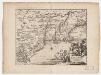
Novi Belgii, quod nunc Novi Jorck vocatur, Novae q[ue] Angliae & partis Virginiae : accuratissima et novissima delineatio
1 : 3500000 Montanus, Arnoldus, 1625?-1683 J. Meurs
Map New York Central Lines.
1 : 4200000 New York Central Railroad Company
United States of America, northern part / drawn under the direction of Mr. Pinkerton by L. Hebert; Neele sculpt. 352 Strand.
from Whole L. Hebert Neele; Mr. Pinkerton,
New York.
from Whole
Novi Belgii Novaeque Angliae nec non partis Virginiae tabula multis in locis emendata
1 : 2000000 a Nicolao Joannis Visschero [S.l.] : [s.n.]
Middle British colonies in America
from Parts
197-198. United States of America, North East. The World Atlas.
1 : 2500000 USSR (Union of Soviet Socialist Republics).
Nordoststaaten der Nordamerikanischen Union
1 : 3000000 New York (New York) Mielisch, H. Umbreit, E.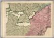
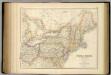
A Map of the British Empire in America. (Sheet 6).
1 : 2000000 Popple, Henry