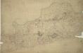
Maps of Greenwich

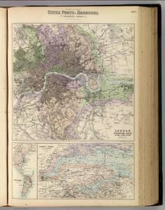
England and Wales, Cities, Ports & Harbours.
1 : 63360 Fullarton, A. & Co.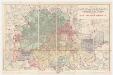
Map of London and its environs : shewing the boundary of the jurisdiction of the metropolitan board of work, also the boundaries of the city of London : Gas companies’ districts
1 : 31680 Standford, Edward, 1827-1904 Edward Standford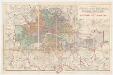
Map of London and its environs : shewing the boundary of the jurisdiction of the metropolitan board of work, also the boundaries of the city of London : Parliamentary boroughs
1 : 31680 Standford, Edward, 1827-1904 Edward Standford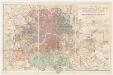
Map of London and its environs : shewing the boundary of the jurisdiction of the metropolitan board of work, also the boundaries of the city of London : Water companies’ district
1 : 31680 Standford, Edward, 1827-1904 Edward Standford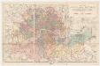
Map of London and its environs : shewing the boundary of the jurisdiction of the metropolitan board of work, also the boundaries of the city of London : Poor law unions
1 : 31680 Standford, Edward, 1827-1904 Edward Standford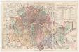
Map of London and its environs : shewing the boundary of the jurisdiction of the metropolitan board of work, also the boundaries of the city of London : Parishes the districts & extra parochial places
1 : 31680 Standford, Edward, 1827-1904 Edward Standford
A Map of London showing the proportion of the inhabitants of each registration sub-district in 1881, born in other parts of the United Kingdom
[Kaart], uit: Bartholomew's road surface map of London & neighbourhood
1 : 30000 Edinburgh : Bartholomew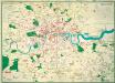
The Lancet Map of Medical London
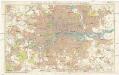
Stanford's new two inch map of London and its environs
1 : 31680 Londýn (Anglie) Edward Stanford
[Recto], uit: L.C.C. trams
1 : 50000 titelvariant: The tramways pocket map & timetable; Annotatie: Omslagtitel: The tramways pocket map & timetable London County Council [London : London County Council]
The fourth sheet of an actual survey of the county of Middlesex in which the parishes within the bills of mortality are bounded with red to be distinguished from the others
1 Blatt : 53 x 70 cm John Rocque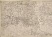
Map of the County of Middlesex in which parishes are bounded with red to be distinguished from the others
The title is missing from this copy of the map. The gives a list of parishes within the Bill of Mortality in scroll at top right with parish boundaries outlined in colour. Land use and reliefs are expressed by symbols, with the built-up area within the City of London represented by stippling. Rocque, John
[Recto], uit: Route map and guide : [London]
1 : 50000 London : London General Omnibus Co.
Kaart van Londen enz. en van het naby gelegen land ruim een uur gaans rondom dezelve stad : getrokken uit de groote gemeeten kaart van de Hr. John Rocque
1 : 63500 Amstersdam : Isaak Tirion
METROPOLITAN BOROUGHS
This map of London was produced for the 1832 Reform Bill that established the metropolitan boroughs. The map's title features along the top; with a compass star at top right, an explanatory note at bottom right. At bottom left is a list of the 'liberties' of the city - the name given to areas exempt from the jurisdiction of the country sheriff, being subject to a separate commission of the peace (in this case royal and governmental authorities). The new boroughs are highlighted in colour, with the shaded area representing the old boundaries of London, Westminster and Southwark. Dawson, Lieut. Robert K.
Map of London [showing] work of the Metropolitan Public Gardens Association, November, 1882, to December, 1900. Scale of miles, 1 1/2[ = 2 1/4 inches]
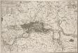
KAART van LONDEN enz en van het NABY GELEGEN LAND ruim een Uur gaans. rondsom dezelve Stad; getrokken uit de groote gemeeten Kaart van de Hr. JOHN ROCQUE, Te AMSTERDAM by ISAAK TIRION 1754
In the second half of the18th century, the introduction of turnpike roads and the increased coach-traffic in and out of London contributed to the popularity of the maps of the countryside around the capital. This map of the area ten miles round the City of London was published in Amsterdam by Isaak Tirion. Based on John Rocque's survey of 1744, the map’s title, imprint and key appears in a table at top left. The scale bars are in a panel below the plan. Built-up areas are stippled in the City and hatched elsewhere. Tirion, Isaak
The METROPOLITAN BOROUGHS As Defined by the reform Bill
This map was produced after the Reform Bill of 1831/32 that created the metropolitan boroughs of London. The title appears at bottom right, with scale bar at bottom left, London arms of at top left, and arms of Westminster at top right. Also at bottom left is a list of 'liberties' - the name given to areas exempt from the jurisdiction of the country sheriff, being subject to a separate commission of the peace (in this case royal and governmental authorities).
[Recto], uit: Map of general routes / Fred J.H. Elston
1 : 12500 Elston, Fred J. H. London : General Omnibus Co.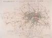
JURISDICTION OF THE METROPOLITAN POLICE
This map illustrates plans for the reform of the jurisdiction of Metropolitan Police. Based on Dawson's map of 1832, the map’s title appear along the top, with compass star at top right, explanatory note at bottom left, and a scale bar at bottom right. District boundaries are highlighted in colour, with the old limits of London, Westminster and Southwark shaded. Formed in 1829, the Metropolitan Police had its jurisdiction extended in 1839to Greater London - an area taken to mean all parishes partly within twelve miles of Charing Cross or wholly within fifteen miles of Charing Cross. In the same year, the City of London formed its own police force. Dawson, Lieut. Robert K.
CRUCHLEY'S New Plan of LONDON and its ENVIRONS
This map is the 11th edition of Cruchley's 'New Plan'. It was altered on each publication, recording the many developments than spanned this period, particularly railway expansion. In this edition the Waterloo and Bricklayers Arms stations are shown, as are Battersea and Victoria Parks. Prior to the establishment of his own business, Cruchley worked for the Arrowsmiths map-publishing firm. Consequently the words “from Arrowsmiths" appear in his imprint on many of his early maps. George Frederick Cruchley
LONDON AND ITS ENVIRONS LEVELS TAKEN BY ORDER OF THE COMMISSIONERS OF SEWERS
The cholera outbreaks of the 1830s and 1840s forced the government to make drastic improvements to the methods of drainage and sewage disposal in London. A Metropolitan Commission of Sewers was charged with the central task of unifying the existing piecemeal drainage system and forming a plan for a completely new one. A new map showing the levels of the land to be drained was needed for this. In March 1848, officers of the Royal Engineers began to prepare stations for triangulation. Observation posts were set up on one of the towers of Westminster Abbey and over the cross of St Paul's. This map is the result of the survey, showing the relative altitude of the land, a necessary preamble to planning drainage systems, as sewage can only be washed away downhill. Wyld, James
London : guide to the International Exhibition, 1862
1 : 15840 Dower, John, fl. 1838-1846? Illustrated London News
LONDON Drawn and engraved expressly for the POST OFFICE DIRECTORY
Map of London published by Benjamin Rees Davies for the Post Office Directory with title and scale bar in table at top right. The London post codes W, N, N.E., E, S.E., S and S.W. are indicated. Davies, Benjamin Rees
LONDON 260
Only the main roads appear on this map, giving the appearance of a rather spacious capital city. The map is covered with a squared grid to allow for the easy calculation of Hackney Cab Fares. New London Bridge is shown without its approaches. Pecked lines show the intended location of the Thames tunnel. East and West India Docks are shown. Rowe, S.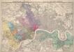
Stanford’s Map of London, shewing the Areas granted to the Electric Light Supply Companies
Edward STANFORD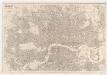
London : drawn and engraved expressly for the post office directory
1 : 253440 Kelly's Directories Ltd Kelly & Co. Ltd., Post Office Directory Office
A new map of London and its environs : from an original survey extending 8 miles east and west, 6 1/4 miles north & south, in which all new and intended buildings, improvements, &c. are carefully inserted
1 : 17150 Thompson, Mr Reeves & Hoare