Maps of Switzerland
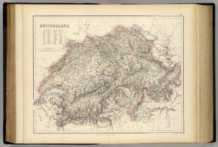
Switzerland.
1 : 696960 Fullarton, A. & Co.
Zweite Keller'sche Reisekarte der Schweiz
Vorderseite: Überarbeitete und ergänzte Ausgabe der ersten Auflage von 1833. Mit einer Nebenkarte der Region Vintschgau/Tirol sowie vier Nebenkarten der Routen aus der Schweiz nach Paris, Würtemberg, Bayern, Tirol, Lyon, Chambery, Mailand, Genua und Turin. Rückseite: Kommentar von Heinrich Keller zur Karte, Übersicht über weitere von Keller gezeichnete und herausgegebene Karten sowie Übersichtsblatt einer anderen Karte. Keller, Heinrich (1778-1862), Kartograf, Panoramenzeichner und Verleger, von Zürich
Reisekarte der Schweiz
Vorderseite: Karte mit fünf Nebenkarten. Rückseite: Titelblatt mit Erklärung der Zeichen und Höhenangaben einiger Seen. Zeichnung: Keller, Heinrich (1778-1862), Kartograf, Panoramenzeichner und Verleger, von Zürich Stich: Scheuermann, Johann Jakob, andere Schreibweise: Scheurmann, (1771-1844), Kupferstecher, von Zofingen AG
Helvetia, cum finitimis regionibus confoederatis. [Karte], in: Theatrum orbis terrarum, sive, Atlas novus, Bd. 1, S. 291.
1 Karte aus Atlas Blaeu, Joan Blaeu, Willem Janszoon
Switzerland
1 : 750000 Topogr. Anst. v. Wurster, Randegger
Helvetia, cum finitimis regionibus confoederatis. [Karte], in: Le théâtre du monde, ou, Nouvel atlas contenant les chartes et descriptions de tous les païs de la terre, Bd. 1, S. 276.
1 Karte aus Atlas Blaeu, Willem Janszoon und Blaeu, Joan Blaeu, Willem Janszoon
Switzerland.
1 : 1450000 Bowen, Frances
Die Schweiz.
1 : 600000 Ziegler, J. M.
Karte von der Schweiz
1 : 575000 1 Karte nach den besten u. vorzüglichsten Hilfsmitteln neu entworfen Gebr. Lotter, Augsburg
Helvetia, cum finitimis regionibus confoederatis. [Karte], in: Novus Atlas, das ist, Weltbeschreibung, Bd. 1, S. 245.
1 Karte aus Atlas Blaeu, Joan Blaeu, Willem Janszoon
Carte générale de l'atlas Suisse
1 : 108000 Weiss, Johann Heinrich ; Scheuermann, Johann Jakob ; Guérin, Christophe ; Meyer, Johann Rudolf J. R. Meyer
Postkarte der schweizerischen Eidgenossenschaft
1 : 300000 Stengel, Johann Rudolf ; Mohr, Ernst Rudolf Topogr. Anstalt v. J. Wurster u. Comp.

Carte itinéraire de la Suisse
1 : 500000 1 Karte par Henri Keller ; écrite par Lallemand chez Hyacinthe Langlois, géographe, Paris
<<Les>> Suisses, leurs sujets et leurs alliéz
1 Karte par N. de Fer ; P. Starckman sculpsit chez l'auteur [i.e. de Fer], Paris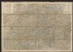
Karte der Schweiz
1 : 400000 Leuzinger, Rudolf J. Dalp (C. Schmid)
Novissima et accuratissima Helvetiae, Rhaetiae, Valesiae, et partis Sabaudiae tabula.
Amsterdam : ex officina R. & J. Ottens
[Kellers Reisekarte der Schweiz]
1 : 500000 1 Karte [Heinrich Keller] [Keller], [Zürich]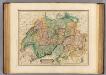
Switzerland.
1 : 760000 Lizars, Daniel
Switzerland.
1 : 1060000 Greenleaf, Jeremiah
Switzerland.
1 : 1060000 Greenleaf, Jeremiah
<<La>> Suisse divisée en ses cantons, ses alliés et sujets et distinguée en pays catholiques, protestans et mixtes
1 : 1250000 1 Karte par [Louis] Brion chez Desnos, Rue St-Jacques au Globe, Paris
Homannův atlas světa
1 : 7000000
Geographische Karte der schweizerischen Gewerbsthätigkeit
1 : 600000 Ziegler, Jakob Melchior Joh. Wurster u. Comp.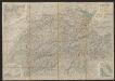
Roadmap of Switzerland
1 : 355000 Müllhaupt, Hans Heinrich ; Bressanini, Rinaldo ; Leuthold, Hans Felix Leuthold
Carte pour l'histoire ancienne de l'Helvétie
1 Karte auf 4 Bl. [Charles Guillaume Loys de Bochat] ; [Jean Philippe Loys de Cheseaux] chés Bousquet, Lausanne
Keller's Reisekarte der Schweiz
1 : 500000 1 Karte Heinrich Fuessli und Comp. Comm., Zürich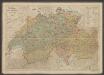
Polit. Einteilung der XIII ört. Eidgenossenschaft vor ihrem Umsturze im Jahre 1798
1 : 600000 Früh, J.U. Schlumpf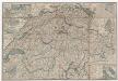
Zweite Reisekarte der Schweiz für Radfahrer und Touristen
1 : 445000 Originaltitel: Deuxième carte routière de la Suisse pour Velopédistes. Vorderseite: Karte mit vier Nebenkarten der Städte Bern, Neuenburg, Genf und Zürich und drei Nebenkarten von Italien, Deutschland und der Südwestschweiz, Tabelle mit Entfernungen zwischen Orten in Stunden sowie Erklärung der Zeichen. Rückseite: Titelblatt mit Informationen zur Karte. Ohne Datumsangabe. Druck: Grafische Druckerei, Bern Verlag: Geografisches Institut Müllhaupt, Bern
Potentissimae Helvetiorum reipublicae cantones tredecim cum foederatis et subjectis provinciis
1 : 615000 Švýcarsko Homann, Johann Baptist Hübner, Johann per Homannianos Heredes